Catalog Archive
Auction 156, Lot 684

"A Chart of the Channel in the Philipine Islands, Through Which the Manila Galeon Passes with a Map of Manila Island", Anon.

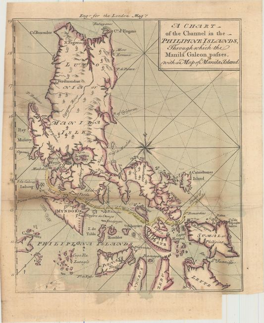
Subject: Philippines

Period: 1763 (circa)

Publication: London Magazine

Color: Hand Color

Size:
8.3 x 10 inches
21.1 x 25.4 cm
Download High Resolution Image
(or just click on image to launch the Zoom viewer)

This boldly engraved chart is based on the large chart from the account of Anson's circumnavigation. The map details the tracks taken by the Spanish galleons between Manila and through the complex of islands leading to the open Pacific Ocean.

References: Jolly (LOND) #227.

Condition: B

Issued folding on watermarked paper with toning along the folds and several extraneous creases. Binding trim at bottom right.

Estimate: $200 - $250

Sold for: $100

Closed on 2/17/2016

Archived