Catalog Archive
Auction 156, Lot 619

"Manasseh Ramus Faecundus, Rumus Faecundus Juxta Fontem", Fuller, Thomas
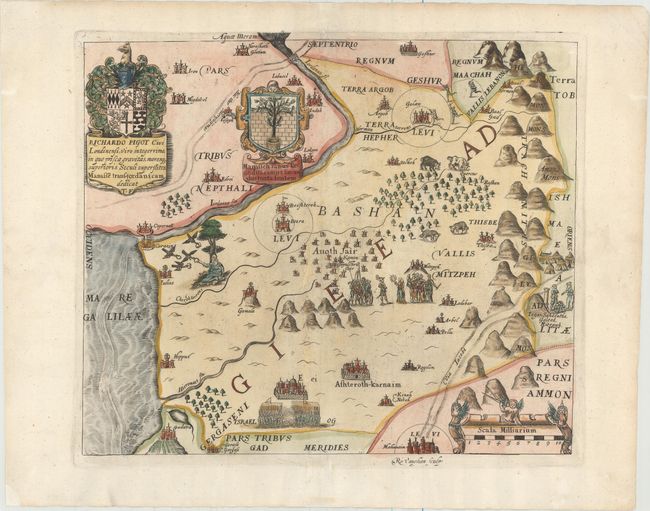
Subject: Holy Land

Period: 1650 (circa)

Publication: A Pisgah-Sight of Palestine

Color: Hand Color

Size:
12.9 x 11 inches
32.8 x 27.9 cm
Download High Resolution Image
(or just click on image to launch the Zoom viewer)

This map depicts Manessah east of the Jordan, with the emblem of the tribe (a tree behind a well) shown in a strapwork cartouche. The map is filled with biblical illustrations and is adorned with an elaborate coat of arms and dedication to Richardo Pigot. Engraved by Robert Vaughan.

Thomas Fuller (1608-1661) was a respected English clergyman who wrote several books on the history and geography of the Holy Land. His A Pisgah-Sight of Palestine, published in 1650 and again in 1662, was a geographical description of the Holy Land with special reference to biblical history. The maps were derived from the cartography of Adrichom supplemented by his own wide reading. Fuller financed the book by dividing it into sections and finding sponsors for each one. To acknowledge the patrons, all maps contained decorative cartouches with the sponsor's coat of arms and a dedication to him.

References: Laor #282; Nebenzahl (HL) p.128-131, #5; Shirley (BL Atlases) G.FULL-1a #4.

Condition: A

A nice impression on watermarked paper with wide margins and attractive color. There are professional repairs to several short separations along the centerfold and small worm tracks, with a minute amount of image replaced in facsimile.

Estimate: $140 - $170

Sold for: $70

Closed on 2/17/2016

Archived