Catalog Archive
Auction 156, Lot 516
"La Germania, la Bella Meta del Turismo Internazionale",
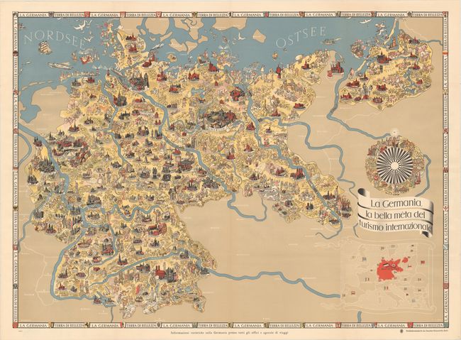
Subject: Germany
Period: 1935 (circa)
Publication:
Color: Printed Color
Size:
44.8 x 32.6 inches
113.8 x 82.8 cm
Download High Resolution Image
(or just click on image to launch the Zoom viewer)
(or just click on image to launch the Zoom viewer)