Catalog Archive
Auction 156, Lot 438

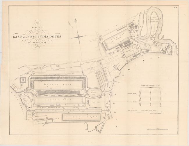
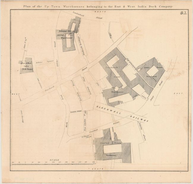
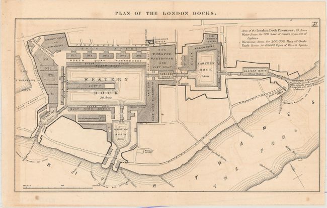
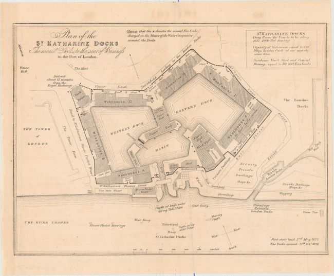
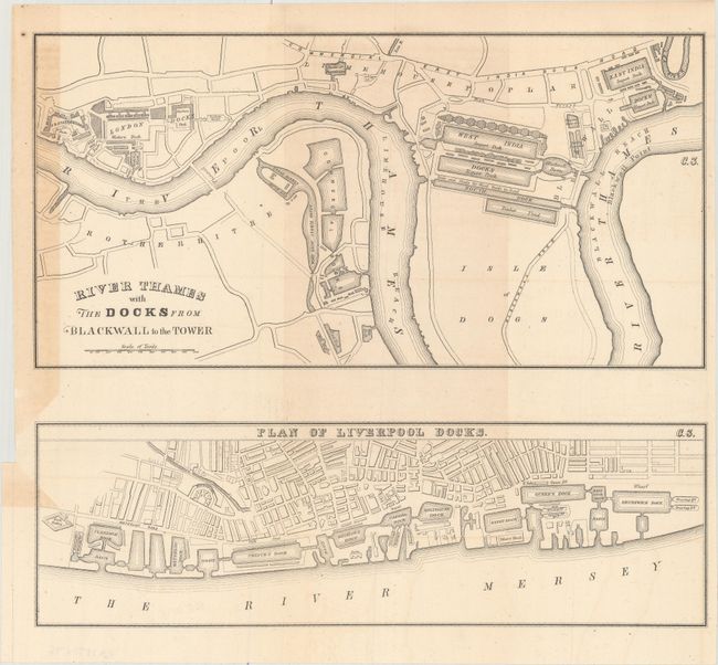
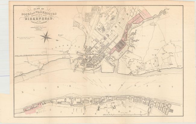
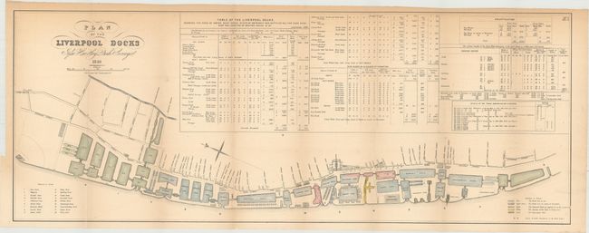
"[Lot of 7] Plan of the East and West India Docks [and] ... Up Town Warehouses... [and] ... London Docks [and] ... St. Katharine Docks... [and] River Thames with the Docks... [and] ... Docks and Warehouses Proposed to Be Made... [and] ... Liverpool Docks",

Subject: London & Liverpool, England

Period: 1841-49 (circa)

Publication:

Color:

Size:
See Description
Download High Resolution Image
(or just click on image to launch the Zoom viewer)

These seven maps show the development of the London and Liverpool docks. The largest map, Plan of the East and West India Docks, shows very good detail of the Eastern and Western docks along the Thames River with several notations along the river's edge displaying the operating companies and individual land holders. Also included is Plan of the Liverpool Docks, which shows good detail of the docks in current operation, those under construction, and proposed docks along the Mersey River. A table above the map is filled with information about water, quay space and dock dimensions for each individual dock.

A. Plan of the East and West India Docks, by C.B. Graham, dated 1841, black & white (21.6 x 16.7").
B. Plan of the Up Town Warehouses Belonging to the East & West India Dock Company, black & white (8.8 x 7.9").
C. Plan of the London Docks, circa 1849, black & white (9.0 x 5.1").
D. Plan of the St. Katharine Docks the Nearest Docks to the Seat of Business, circa 1849, black & white (8.9 x 6.6").
E. River Thames with the Docks from Blackwall to the Tower [on sheet with] Plan of Liverpool Docks, black & white (11.9 x 10.5").
F. Plan of Docks and Warehouses Proposed to Be Made at Birkenhead, in the County of Chester, by C.B. Graham, dated 1844, hand color (16.6 x 11.0").
G. Plan of the Liverpool Docks, by C.B. Graham, dated 1846, hand color (29.8 x 11.3").

References:

Condition: B+

Light toning, faint offsetting, and some extraneous creasing.

Estimate: $180 - $220

Sold for: $60

Closed on 2/17/2016

Archived