Catalog Archive
Auction 156, Lot 431

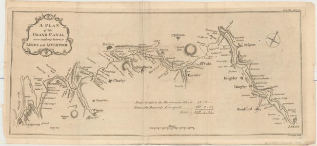
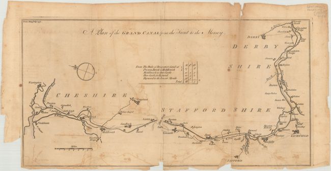
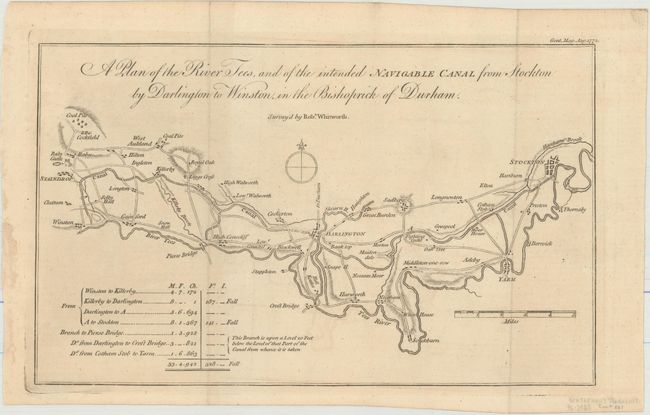
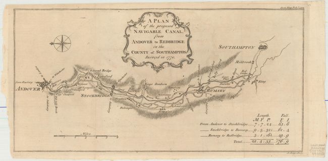
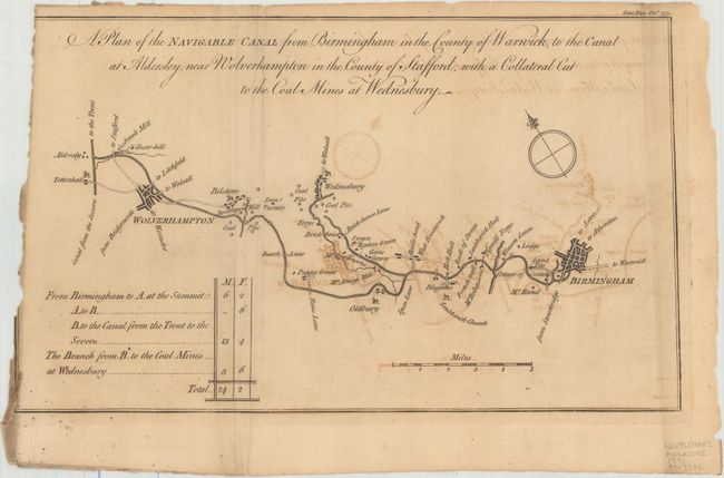
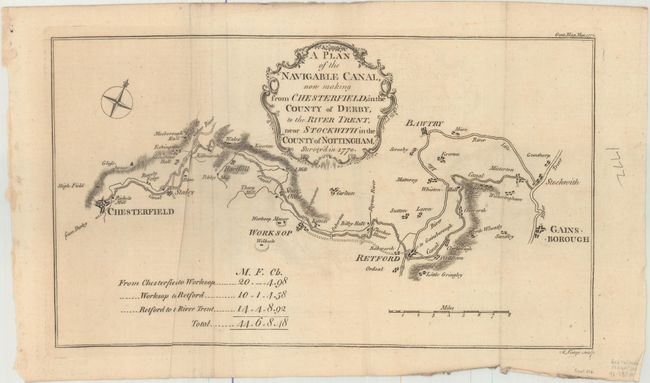
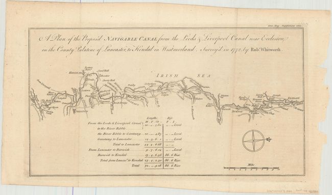
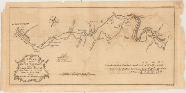
"[Lot of 8 - Plans of English Canals from Gentleman's Magazine]",

Subject: England

Period: 1771-72 (dated)

Publication: Gentleman's Magazine

Color: Black & White

Size:
See Description
Download High Resolution Image
(or just click on image to launch the Zoom viewer)

This lot includes 8 copper-engraved maps depicting the canal networks in England, all published in Gentleman's Magazine in 1771 and 1772.

A. A Plan of the Grand Canal Now Making Between Leeds and Liverpool, dated 1772 (16.5 x 7.1"). Engraved by J. Lodge. Condition: Issued folding with minor offsetting and a few faint spots. There are some tiny chips and tears in the blank margins. (B+)
B. A Plan of the Grand Canal from the Trent to the Mersey, dated 1771 (15.0 x 7.8"). Condition: Issued folding on a toned sheet with light offsetting, a couple spots, and several chips and tears, including a 2" fold separation at top right. There is a binding trim at bottom left with an associated tear that enters into the neatline. A tiny portion of neatline is missing at bottom. (C+)
C. A Plan of the River Tees, and of the Intended Navigable Canal from Stockton by Darlington to Winston, in the Bishoprick of Durham, dated 1772 (11.3 x 6.9"). Condition: Issued folding with faint offsetting. (A)
D. A Plan of the Proposed Navigable Canal, from Andover to Redbridge. In the County of Southampton. Surveyd in 1770, dated 1772 (13.6 x 6.8"). Condition: Issued folding with minor offsetting. (A)
E. A Plan of the Navigable Canal from Birmingham in the County of Warwick, to the Canal at Aldersley, Near Wolverhampton..., dated 1771 (11.7 x 6.9"). Engraved by J. Lodge. Condition: A nice impression issued folding on a watermarked sheet with light offsetting, short fold separations, and a chip at left with the majority of the left neatline missing. (C+)
F. A Plan of the Navigable Canal, Now Making from Chesterfield, in the County of Derby, to the River Trent, Near Stockwith in the County of Nottingham, Survey'd in 1770, dated 1772 (11.8 x 6.8"). Condition: A nice impression on a watermarked sheet with faint offsetting and some extraneous creasing. (B+)
G. A Plan of the Propos'd Navigable Canal from the Leeds & Liverpool Canal Near Eccleston in the County Palatine of Lancaster, to Kendal in Westmorland. Survey'd in 1772, by Rob.t Whitworth, dated 1772 (12.3 x 6.6"). Condition: Issued folding with faint offsetting and some small chips in the blank margin at right. (A)
H. A Plan of the River Salwarp. And of the Navigable Canal, from Droitwich. To the River Severn. In the County of Worcester, dated 1771 (13.6 x 6.4"). Engraved by J. Lodge. Condition: Issued folding on watermarked paper with light offsetting and toning, a couple short fold separations, and a few small chips in the right blank margin. (B)

References: Jolly #GENT-211, 213, 214, 215, 218, 219, 221, & 223.

Condition:

See description above.

Estimate: $275 - $350

Sold for: $150

Closed on 2/17/2016

Archived