Catalog Archive
Auction 156, Lot 366

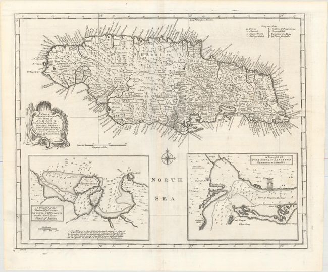
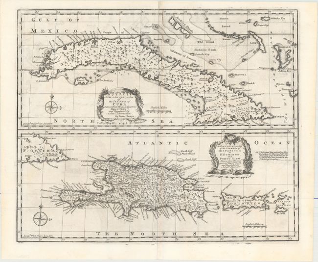
"[Lot of 2] A New & Accurate Map of the Island of Jamaica. Divided into Its Principal Parishes... [and] A New & Accurate Map of the Island of Cuba... [on sheet with] A New & Accurate Map of the Islands of Hispaniola or St. Domingo, and Porto Rico...", Bowen, Emanuel

Subject: Greater Antilles

Period: 1747 (circa)

Publication: A Complete System of Geography...

Color: Black & White

Size:
16.5 x 13.6 inches
41.9 x 34.5 cm
Download High Resolution Image
(or just click on image to launch the Zoom viewer)

A. A New & Accurate Map of the Island of Jamaica. Divided into Its Principal Parishes... This highly detailed map of the island shows towns, churches, sugar works and indigo works. Surrounded by place names along the coast, the map identifies rivers, roads, forests and topography. Includes insets at bottom "A Draught of the Harbour of Port Antonio & St. Francis..." and "A Draught of Port Royal, or Kingston Harbor..." Both insets are filled with soundings and shoals to aid in navigation.

B. A New & Accurate Map of the Island of Cuba... [on sheet with] A New & Accurate Map of the Islands of Hispaniola or St. Domingo, and Porto Rico... Two detailed and beautifully engraved maps on a single sheet, one showing Cuba and the other, Hispaniola and Puerto Rico. Both are "Drawn from the most approved Maps and Charts, and Regulated by Astron'l Observat'ns." Each map is graced by a charming rococo style cartouche and includes a compass rose.

References: McCorkle (18th c. Geography Books) #17-35 & #17-36 (Vol II); Shirley (BL Atlases) T.BOW-2a #65 & 66.

Condition: A

Nice dark impressions on clean sheets with very faint offsetting and archivally repaired short centerfold separations confined to the bottom blank margins.

Estimate: $300 - $375

Unsold

Closed on 2/17/2016

Archived