Catalog Archive
Auction 156, Lot 358

"A General Chart of the West Indies, Including the Gulf of Mexico, with an Enlarged Plan of the Island of Jamaica...", Hobbs, J. S.

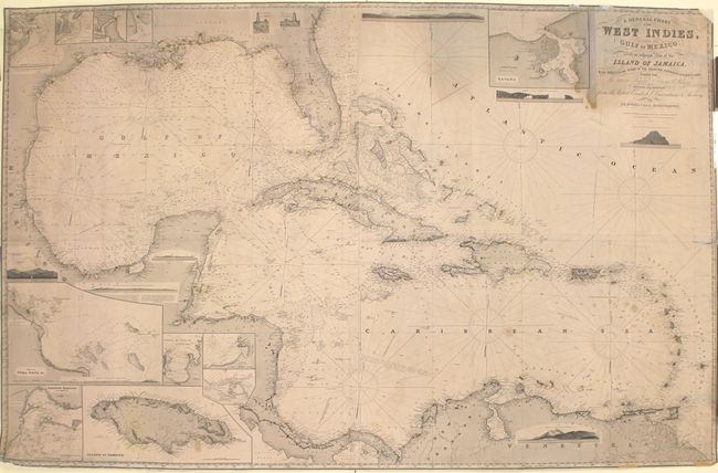
Subject: Gulf of Mexico & Caribbean

Period: 1890 (dated)

Publication:

Color: Black & White

Size:
64.4 x 41.3 inches
163.6 x 104.9 cm
Download High Resolution Image
(or just click on image to launch the Zoom viewer)

This massive blue-backed sea chart provides a detailed look into the Gulf of Mexico and Caribbean Sea. It includes soundings, lights, hazards, shoals, currents, and other navigational information. The coastlines are dense with place names, while inland there is little detail. There are a number of views depicting lighthouses and coastal outlines and eleven insets, including one of the island of Jamaica, the port of Vera Cruz, and a city plan of Havana. The lighthouses are marked in original hand color in red and yellow. Published by Charles Wilson, of J. W. Norie and Wilson. On 4 joined sheets.

References:

Condition: B

A fine impression with original color and some manuscript notations in pencil. There are small chips and edge tears, including a 12" tear at right and three small portions of the border that are missing at bottom, as well as light damp stains (primarily at top right) and soiling.

Estimate: $550 - $700

Sold for: $400

Closed on 2/17/2016

Archived