Catalog Archive
Auction 156, Lot 320
"Map of the Sources of Snake River, with its Tributaries together with Portions of the Headwaters of the Madison and Yellow Stone…", Hayden, Ferdinand Vandeveer
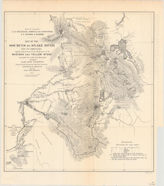
Subject: Wyoming, Yellowstone
Period: 1873 (circa)
Publication:
Color: Black & White
Size:
10 x 10.5 inches
25.4 x 26.7 cm
Download High Resolution Image
(or just click on image to launch the Zoom viewer)
(or just click on image to launch the Zoom viewer)