Catalog Archive
Auction 156, Lot 287

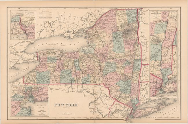
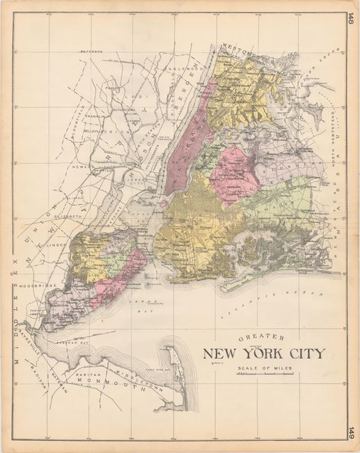
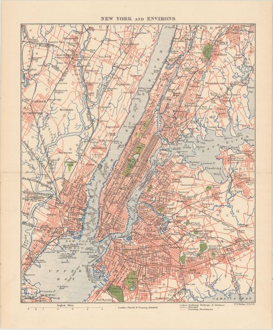
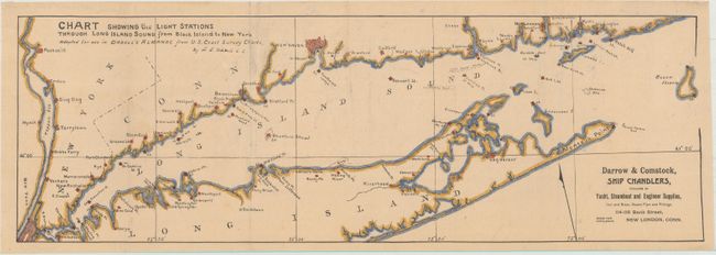
"[Lot of 4] New York [and] Greater New York City [and] New York and Environs [and] Chart Showing the Light Stations Through Long Island Sound from Block Island to New York...",

Subject: New York

Period: 1876-1912 (circa)

Publication:

Color:

Size:
See Description
Download High Resolution Image
(or just click on image to launch the Zoom viewer)

A. New York, by Frank A. Gray, dated 1876, hand color (24.4 x 16.4"). This handsome map of the state is divided into counties. Towns and cities, rivers, railroads, and canals are located. There are three detailed insets: Niagara River and Vicinity, Map of the Hudson River from New York to Saratoga Springs, and Vicinity of New York. Lakes Erie and Ontario are shown with their height above sea level and average depth. Condition: There is minor offsetting, archivally repaired centerfold separations at top and bottom, and some edge tears, a couple of which just enter into map image. The sheet's edges are toned. (B+)

B. Greater New York City, by L.H. Everts & Co., from New Century Atlas of Counties of the State of New York, circa 1912, hand color (22.3 x 28.4"). This large map of New York City identifies all five boroughs and numerous neighborhoods. Much of the city is laid out in a grid-like plan, and roads and railroads are delineated. It names several bays and beaches and extends into New Jersey. Condition: There are a couple of small, unobtrusive spots. Light damp stains and toning are confined to the sheet's edges. (A)

C. New York and Environs, by Francis Sidney Weller, circa 1890, printed color (7.8 x 9.4"). This intricate plan of New York City and its immediate surroundings spans from the Palisades and Mount Vernon south to Flatbush. Street names, ferry lines, railways, bays, neighborhoods, and more are identified. The Statue of Liberty, Central and Prospect parks, and Greenwood Cemetery appear. Published by Cassell & Company in London. Condition: Near fine. (A)

D. Chart Showing the Light Stations Through Long Island Sound from Block Island to New York..., by L.E. Daboll, from New England Almanac and Farmers' Friend, circa 1894, hand color (19.9 x 6.7"). This lovely chart centers on Long Island Sound and spans from Tappan Zee to Block Island. New Haven and part of New York City appear in grid-like plans. Various lights are marked, and reefs and shoals are located. Condition: Issued folding with some light spots, extraneous creasing, a couple tiny worm holes, and some short fold separations confined to the blank margins. (B+)

References:

Condition:

See description above.

Estimate: $160 - $200

Sold for: $120

Closed on 2/17/2016

Archived