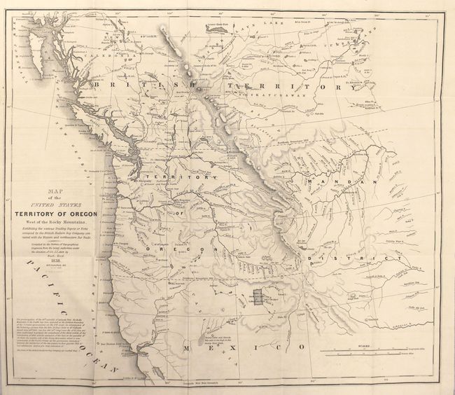
"Map of the United States Territory of Oregon West of the Rocky Mountains, Exhibiting the Various Trading Depots or Forts Occupied by the British Hudson Bay Company Connected with the Western and Northwestern Fur Trade [with report]", Abert/Hood
1 of 2
Subject: Northwestern United States
Period: 1838 (dated)
Publication: Report of the Senate Select Committee on the Occupation of the Oregon Country
This map was issued in an important report intended to awaken public interest in the American occupation of Oregon Territory in the controversy with Great Britain, who also claimed the territory south to the Columbia River. Among the many interesting details on the map are the locations of the various trading posts or forts connected with the American and British northwestern fur trade. It covers present day Oregon, Washington, Idaho, Montana and Wyoming. The region east of the Rocky Mountains is named Mandan District. It also shows much of southwestern Canada. The map was copied from John Arrowsmith's 1832 map of British North America. At lower left is the wording of an ultimatum given to the British by Henry Clay, Secretary of State, stating that the 49th parallel will be the boundary. Engraved by M.H. Stansbury. Accompanied by the 78-page disbound report.