Catalog Archive
Auction 156, Lot 154

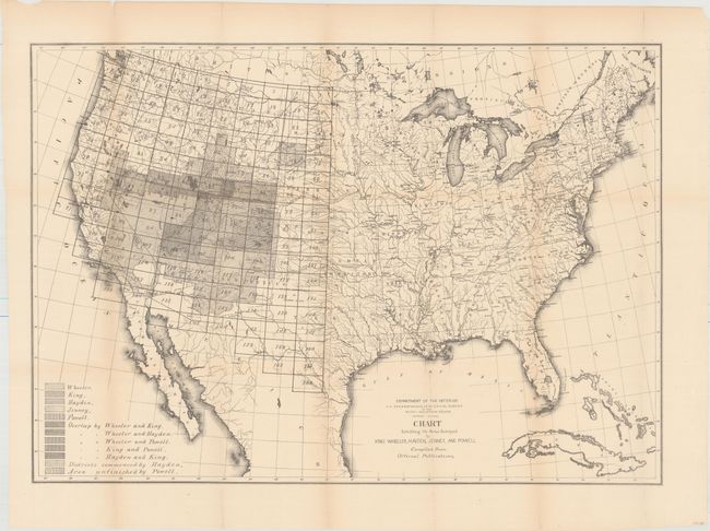
"Chart Exhibiting the Areas Surveyed by King, Wheeler, Hayden, Jenney, and Powell Compiled from Official Publications", U.S. Department of Interior

Subject: United States

Period: 1878 (published)

Publication: HR Doc. 80, 45th Congress, 2nd Session

Color: Black & White

Size:
28.3 x 19.8 inches
71.9 x 50.3 cm
Download High Resolution Image
(or just click on image to launch the Zoom viewer)

A remarkable map that reflects the survey efforts west of the 100th meridian, including the important surveys of King (40th parallel), Wheeler, Powell, Jenney and Hayden. The map uses different patterns to identify the various surveys and where there was overlap. This map was published 2 years before the first annual report of the Geological Survey, which included similar maps showing the extent of surveying progress in the west. No auction records or dealer listings in the last 30 years, and only two copies were located in institutions.

References:

Condition: B+

Issued folding with light toning along the folds, several fold separations and edge tears confined to the blank margins, and some extraneous creasing along one fold.

Estimate: $160 - $200

Sold for: $80

Closed on 2/17/2016

Archived