Catalog Archive
Auction 156, Lot 141

"Das Oregon-Gebiet", Flemming, Carl

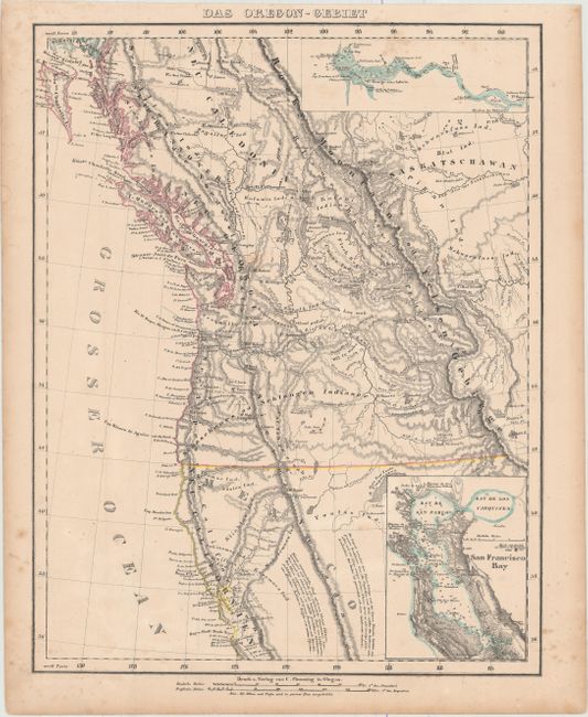
Subject: Western United States & Canada

Period: 1848 (circa)

Publication:

Color: Hand Color

Size:
12.6 x 16.4 inches
32 x 41.7 cm
Download High Resolution Image
(or just click on image to launch the Zoom viewer)

This uncommon German map of Oregon Territory shows the U.S. claim extending well into British Columbia to 54°40. The map reaches south to Monterey, and inland to the Sierra Nevadas and Rocky Mountains. The information is taken from the maps of Fremont and other western explorers. The Columbia River and San Francisco Bay are included in detailed insets, complete with soundings.

References:

Condition: B+

Original outline color with minor toning and light scattered foxing primarily in the blank margins.

Estimate: $200 - $250

Sold for: $150

Closed on 2/17/2016

Archived