Catalog Archive
Auction 156, Lot 127

"A New & Accurate Map of North America, Including the British Acquisitions Gain'd by the Late War", Entick, John

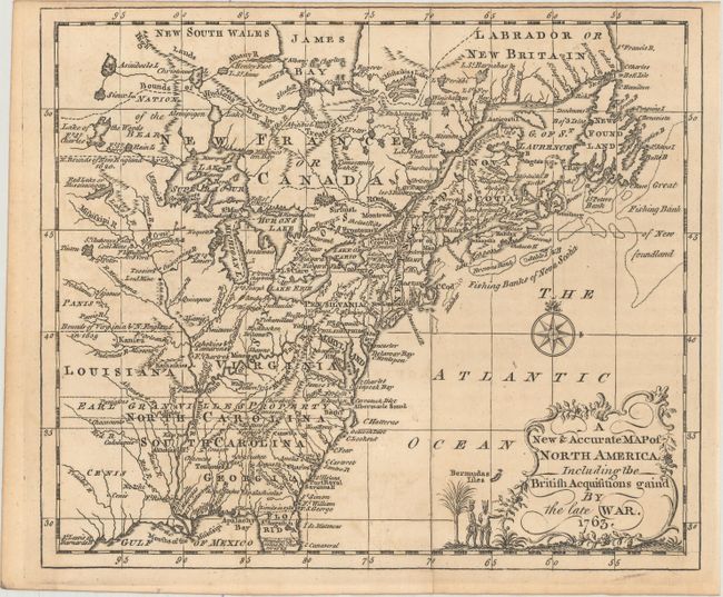
Subject: Colonial Eastern United States & Canada

Period: 1763 (dated)

Publication: General History of the Late War

Color: Black & White

Size:
9 x 7.6 inches
22.9 x 19.3 cm
Download High Resolution Image
(or just click on image to launch the Zoom viewer)

This scarce little map covers the eastern part of North America from James Bay to the Gulf of Mexico. It shows boundaries, colonies, towns, cities, forts, and Indian tribal territory. Earl Granville's Property is shown to extend past the Mississippi to the western edge of the map. Embellished with a quaint title cartouche and compass rose. Published in 1766.

References: McCorkle #766.2; Sellers & Van Ee #105.

Condition: B+

A crisp impression issued folding with faint offsetting.

Estimate: $350 - $425

Sold for: $150

Closed on 2/17/2016

Archived