Catalog Archive
Auction 155, Lot 701

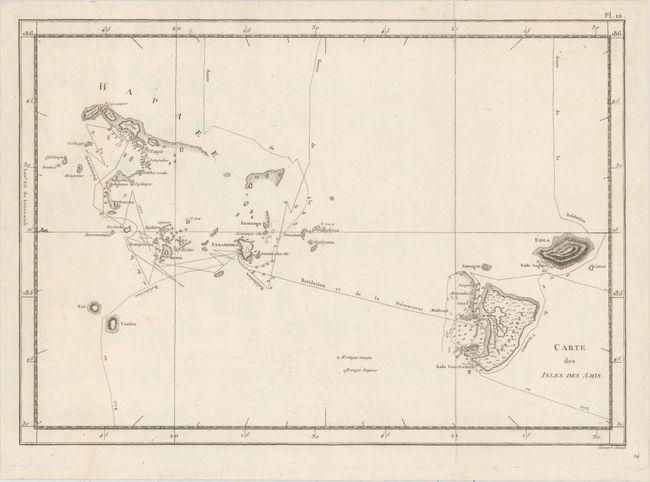
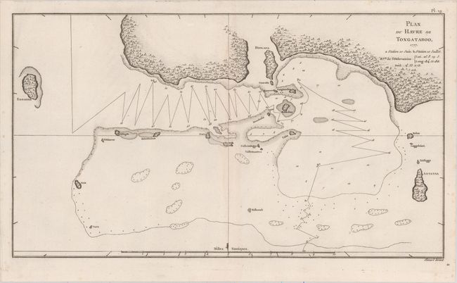
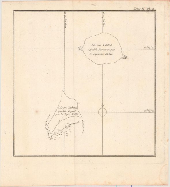
"[Lot of 4] Carte des Isles des Amis [and] Plan du Havre de Tongataboo [and] [Isle des Cocos... / Isle des Traitres] [and] Danse de Nuit Executee par les Hommes de Hapaee", Cook/Benard

Subject: Tonga Islands

Period: 1785 (circa)

Publication: Troisieme Voyage De Cook, ou Voyage a l'Ocean Pacifique...

Color: Black & White

Size:
See Description
Download High Resolution Image
(or just click on image to launch the Zoom viewer)

Captain James Cook (1728-1779) is best known for his three voyages to the Pacific (1768-71; 1772-75; and 1776-79). His discoveries radically changed the western understanding of the world in the late 18th century. He was the first to circumnavigate and chart New Zealand and provided the earliest European accounts of exploration along the eastern coast of Australia and the Hawaiian Islands. On February 14th, 1779, he was killed on Hawaii after attempting to kidnap the chief of the island.

Many contemporary accounts of Cook’s voyages, including charts and engravings, appeared in the late 18th century. The first official account of Cook’s first voyage was published in 1773 by John Hawkesworth in Volumes II and III of An Account of the Voyages Undertaken by the Order of His Present Majesty for Making Discoveries in the Southern Hemisphere... William Strahan and Thomas Cadell published the first official accounts of the second and third voyages in 1777 and 1784. Accounts of his exploration were subsequently translated into French, German, and Dutch.

This interesting lot features three maps and a view from the Kingdom of Tonga. Cook named this group the Friendly Islands due to the generous reception he and his crew received when they first arrived there during their second journey. The first chart shows the Tongatapu and Ha'apai groups with the track of Cook's ship, the Resolution. The second zooms in on a segment of Tongapatu's northern coast. Tafahi (Isle des Cocos or Boscawen) and Niuatoputapu (Keppel) are depicted on the third sheet. Based on the work of John Webber, one of the official artists along for Cook's journey, the view shows the men of one of the Ha'apai islands performing a dance at night. All of the sheets were engraved by Benard.

A. Carte des Isles des Amis, (13.6 x 9.5").
B. Plan du Havre de Tongataboo, 1777, (15.7 x 8.9").
C. [Isle des Cocos... / Isle des Traitres], (7.6 x 7.8").
D. Danse de Nuit Executee par les Hommes de Hapaee, (15.1 x 8.8").

References:

Condition: A

All of the sheets feature nice impressions and the maps are on watermarked paper. There are minor, unobtrusive spots.

Estimate: $160 - $190

Sold for: $80

Closed on 11/18/2015

Archived