Catalog Archive
Auction 155, Lot 42

"A Map of the North Pole with All the Territories That Lye Near It, Known to Us &c. According to the Latest Discoveries, and Most Exact Observations. Agreeable to Modern History", Moll, Herman
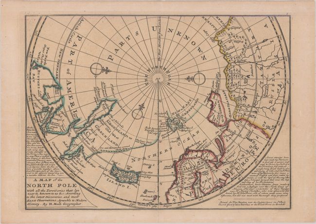
Subject: North Pole

Period: 1732 (published)

Publication: Atlas Minor

Color: Hand Color

Size:
10.9 x 8 inches
27.7 x 20.3 cm
Download High Resolution Image
(or just click on image to launch the Zoom viewer)

This unusual map depicts the North Pole and shows incomplete northern coastlines for North America and Greenland. Novaya Zemlya is correctly shown as an island facilitating a Northeast Passage to Asia. Above the Pole is Parts Unknown, and three compass roses complete the composition. This is the second state of the map, which includes a publisher's imprint and two panels of text flanking the map.

References: Kershaw #408; Shirley (BL Atlases) T.MOLL-9b.

Condition: A

A nice impression on a watermarked sheet with faint toning. There is archival tape reinforcing the centerfold to repair a short separation at bottom.

Estimate: $200 - $240

Sold for: $150

Closed on 11/18/2015

Archived