Catalog Archive
Auction 155, Lot 339

"Carta Maritima del Reyno de Tierra Firme u Castilia del Oro Comprehende el Istmo y Provincia de Panama...", Lopez, Juan (don)
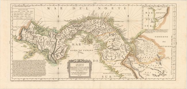
Subject: Panama

Period: 1785 (dated)

Publication:

Color: Hand Color

Size:
30.7 x 14.3 inches
78 x 36.3 cm
Download High Resolution Image
(or just click on image to launch the Zoom viewer)

This is a rare Spanish map of western Panama, from the Costa Rican border to a portion of northwestern Colombia. Rivers and mountain ranges fill the region. Towns are labeled along the coasts, with several roads depicted around Panama City. A flaming Volcan Baru is shown along the border with Costa Rica, despite the fact that it is not believed to have erupted since 500 AD. A block of text in the Pacific Ocean attributes the cartography to d'Anville, de Herrera, Bellin, Jefferys, and others. At top right is an inset depicting the province of Biruquete, which continues the map further south into Colombia. On two sheets joined, as issued.

References: Shirley (BL Atlases) T.LOP-2a #75; Kapp (MCC-73) #87.

Condition: A

A crisp impression with original color on watermarked paper. Issued folding with a few faint spots of foxing, primarily in the blank margins.

Estimate: $800 - $950

Sold for: $750

Closed on 11/18/2015

Archived