Catalog Archive
Auction 155, Lot 264

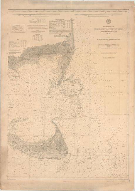
"Coast Chart No. 111 From Monomoy and Nantucket Shoals to Muskeget Channel Mass...", U.S. Coast & Geodetic Survey

Subject: Massachusetts

Period: 1890 (dated)

Publication:

Color: Hand Color

Size:
27.2 x 37.8 inches
69.1 x 96 cm
Download High Resolution Image
(or just click on image to launch the Zoom viewer)

This highly detailed chart extends from Cape Cod south to Nantucket. It features a plethora of depth soundings, bottom types, buoys, wrecks, shoals, lighthouses, and more. There is fine topographical detail inland. Above Cape Cod are two views of Nantucket's coast, an inset diagram of charts, a key to the abbreviations used on the chart, tables on the tides, currents, and lighthouses and beacons, and other relevant information. Engraved by A. Sengteller, G. McCoy, W. Phillips, and E.A. Maedel. Issued in September 1888 and printed August 21, 1890, according to a stamp below the bottom neatline.

References:

Condition: B

There is light soiling, minor extraneous creasing, and several short tears and small chips in the blank margins.

Estimate: $200 - $240

Sold for: $300

Closed on 11/18/2015

Archived