Catalog Archive
Auction 155, Lot 107

"North America West Coast Vancouver Island Esquimalt Harbour Surveyed by Captn. G.H. Richards & the Officers of H.M.S. Plumper...", British Admiralty

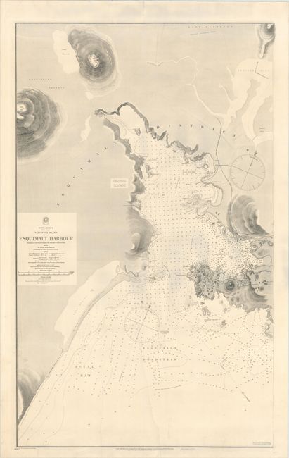
Subject: Vancouver Island, Canada

Period: 1897 (dated)

Publication:

Color: Black & White

Size:
24.9 x 40.3 inches
63.2 x 102.4 cm
Download High Resolution Image
(or just click on image to launch the Zoom viewer)

This finely detailed, large-scale chart depicts Esquimalt Harbor at the southern tip of Vancouver Island. The harbor is filled with soundings, anchorages, shoals, kelp, and navigational information. Excellent topographical details are shown inland, with relief depicted with hachures. The western tip of the town of Esquimalt is shown as a bird's-eye plan, with individual buildings and roads depicted. Surveyed by Captain G. H. Richards and the officers of the HMS Plumper in 1858, with the interior drawn from a survey by J. D. Pemberton in 1860. Major corrections were incorporated into the chart in 1873, with additional small corrections in 1897. Backed in linen.

References: Phillips (Maps) p. 953.

Condition: B+

Clean and bright with original color (red and yellow) on lighthouse. Backed in linen to reinforce a crease at top and to repair two long tears (6" and 17") at bottom.

Estimate: $400 - $500

Unsold

Closed on 11/18/2015

Archived