Catalog Archive
Auction 154, Lot 776

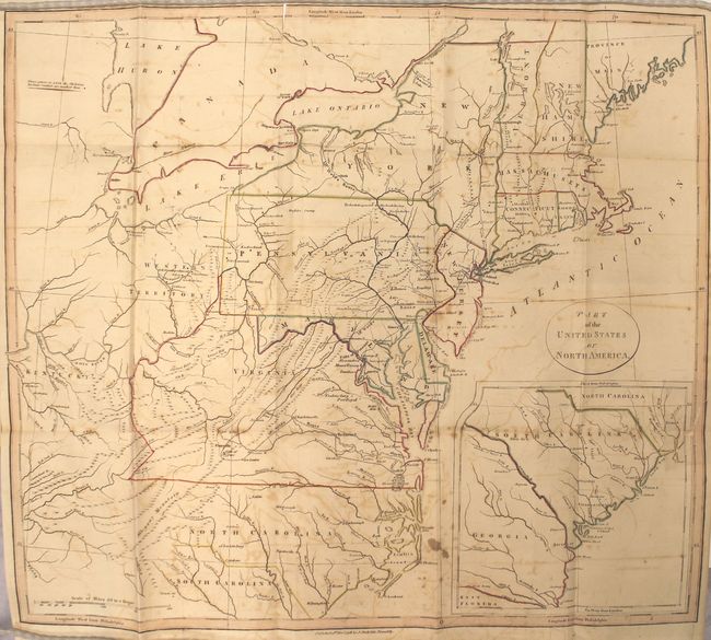
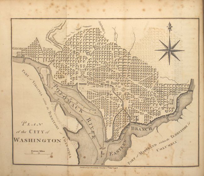
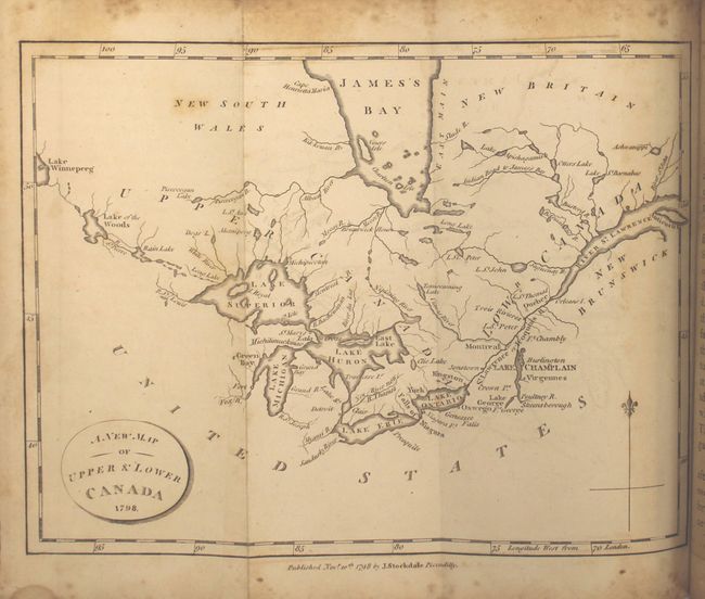
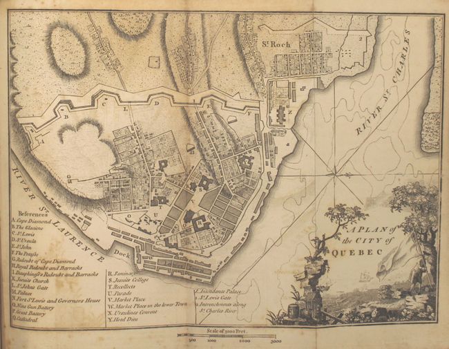
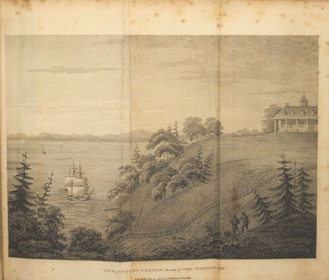
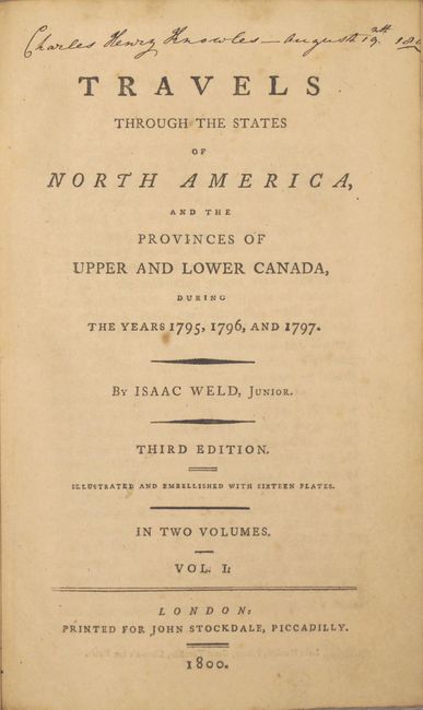
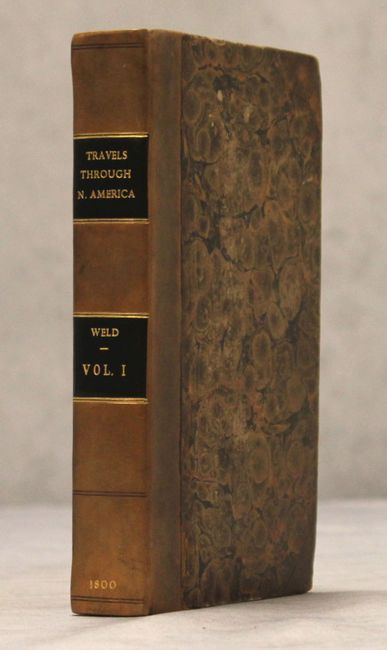
"Travels Through the States of North America, and the Provinces of Upper and Lower Canada, During the Years 1795, 1796, and 1797 ... Vol. I", Weld, Isaac

Subject: Exploration and Surveys, North America

Period: 1800 (published)

Publication:

Color: Black & White

Size:
5.5 x 8.4 inches
14 x 21.3 cm
Download High Resolution Image
(or just click on image to launch the Zoom viewer)

Weld, an Irish-born topographer, arrived to Philadelphia in 1795, and his subsequent travels took him through the mid-Atlantic states where he met George Washington and Thomas Jefferson. He then continued to Montreal and Quebec and, following the St. Lawrence River, journeyed to the lakes of Kingston, Niagara and Detroit. His description of the country and its settlements are often unflattering, but provide a fascinating early view of the emerging nation. This is the third English edition of Weld's work, printed for John Stockdale. This lot consists of the first volume only of a two-volume edition, with the second volume focusing in part on Niagara Falls. This volume includes seven folding plates and the following four folding maps/plans:

A. Part of the United States of North America (18.3 x 16.2"). This map of the young United States is filled with great information on early development including roads and settlements. The map covers from the Province of Main through North Carolina with a large inset of South Carolina and Georgia. West of the states are the Western Territory and Kentucky. The villages of "Christian Indians" are located by numerous large icons. Condition: Moderate offsetting with a couple of small stains, a 1" fold separation at top, and a 1/2" binding tear at left. A tear that enters 1" into map at right has an old paper repair on verso. (B)

B. Plan of the City of Washington (8.5 x 6.6"). Condition: Light offsetting, a few small stains, and scattered foxing primarily confined to the blank margins. (B)

C. A New Map of Upper & Lower Canada (9 x 6.8"). Condition: Faint offsetting with a few spots of foxing in the image and moderate foxing in the blank margins. (B+)

D. A Plan of the City of Quebec (9.4 x 6.8"). Condition: Light offsetting with some uneven toning. (B)

Plates include an American Stage Wagon, a Canadian Calash, and views of Mount Vernon, Hudson River, Cohoes Falls, Cape Diamond, and Natural Bridge, Virginia. Octavo, 427 pp. Quarter leather with tips over marbled boards. Gilt title and embossed bands on spine. Book was professionally rebound with new leather spine, keeping original boards.

References: Howes #W235; McCorkle #798.5; Sabin #102541.

Condition: B

The plates range in condition from good to very good with light toning and scattered foxing. See above for a description of the maps. The text is clean and bright with a few pencil marks and an occasional spot of foxing, and the leaves facing the maps and plates are moderately toned. The binding is sound and the covers show light wear. The new spine is in excellent condition.

Estimate: $400 - $475

Sold for: $425

Closed on 9/16/2015

Archived