Catalog Archive
Auction 154, Lot 775

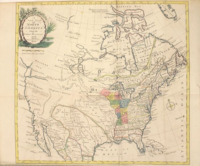
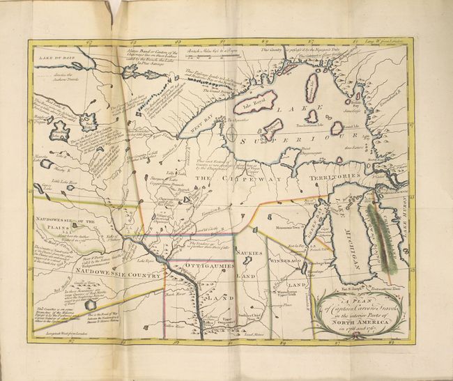
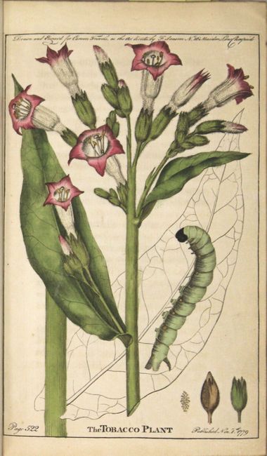
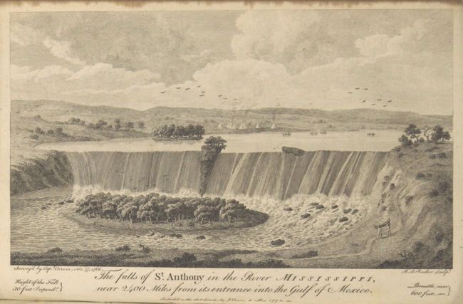
Carver's Landmark Work on the Exploration of the American West

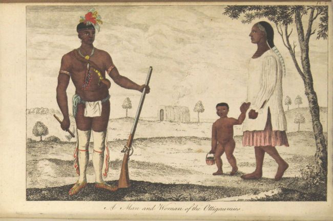
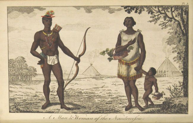
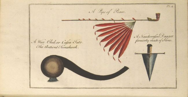
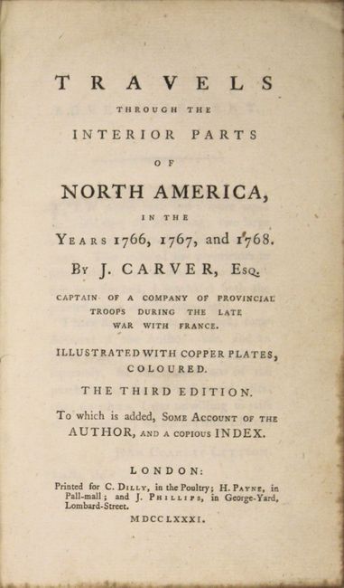
"Travels Through the Interior Parts of North America, in the Years 1766, 1767, and 1768 ... the Third Edition...", Carver, Jonathan (Capt.)

Subject: Exploration and Surveys

Period: 1781 (published)

Publication:

Color: Hand Color

Size:
5.3 x 8.4 inches
13.5 x 21.3 cm
Download High Resolution Image
(or just click on image to launch the Zoom viewer)

This fascinating book is Jonathan Carver's travelogue of his expedition to find a western water route to the Pacific Ocean. Born in Massachusetts in 1710, Carver enlisted in the Massachusetts colonial militia at the beginning of the French and Indian War, during which he learned surveying and mapping techniques. At the conclusion of the war, Carver quit the military with the hopes of exploring the new territories acquired by the British. In 1766, Carver was appointed by Robert Rogers to lead an expedition via lakes and rivers to the Pacific. Beginning at Fort Michilimackinac on present-day Mackinac Island, Carver traveled through Wisconsin, Minnesota, and Iowa over the next several years. Although he returned back to Fort Michilimackinac without completing his mission, Carver's expedition was notable for several discoveries. Carver traveled further west than any English-speaking explorer previously had, or would, until after the Revolutionary War. He is also credited as the first to note a large mountain range extending north-south to the west of the Mississippi River. And although he did not coin the term, Carver was the first to use the term "Oregon" in print, and his book served to popularize the term. Carver's book was quite successful, and was published in over thirty editions. This edition includes two maps and five plates depicting St. Anthony Falls, Native Americans and their tools, and a tobacco plant. The two maps are:

A New Map of North America. This uncommon map shows the route that Carver and his party were seeking with a boldly depicted River of the West connected by a dotted line to Pikes Lake, which is connected to the Mantons River (upper Missouri River). The Western Sea is noted in the Pacific Northwest, but is not delineated. At top Carver also hints at a Northwest Passage, with the note "the Suppos'd Eskimeaux Passage to the South Sea." The map features a delicately engraved title cartouche with a tree overlooking a river with a sailing ship.

A Plan of Captain Carvers Travels in the interior Parts of North America in 1766 and 1767. A terrific early map of the region of today's Wisconsin and Minnesota. Filled with details and notations such as "Traders go no farther than these falls" and "seldom travel this way except War Parties" and many more. The route of Carver's travels are clearly shown along the Mississippi, Fox, Minnesota and St. Pierre rivers. The map extends from Michigan, here labeled Chipeways and Ottowas Land, to above Lake Superior and west to beyond the Minnesota River.

Third edition. Two folding maps, 5 plates, title page, dedication, address, table of contents, introduction, 543 pp. text, dictionary of Chippewah language, appendix. Octavo, quarter leather with gilt embossing and leather title labels on spine and marbled-paper covered boards.

References: Wheat (TMW) #175; Howes #C-215.

Condition: A

Condition grade is for the maps and plates, which are clean and bright with original color, except for the plate of St. Anthony Falls, which is black and white. The North America map has a printer's crease at bottom left and a binding tear confined to the right blank margin. The <i>Plan of Captain Carvers Travels</i> has light toning along one fold, a fold separation in top blank margin, and a binding tear confined to the right blank margin. The text is very clean and bright, with a light damp stain along top entering about 50 pages, not affecting plates or maps. The hinges are starting, the covers show moderate wear, and the spine is beginning to crack.

Estimate: $2,000 - $2,300

Sold for: $1,500

Closed on 9/16/2015

Archived