Catalog Archive
Auction 154, Lot 773

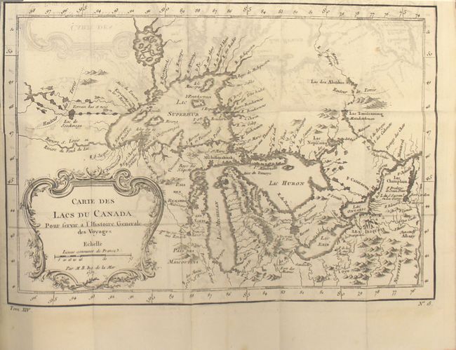
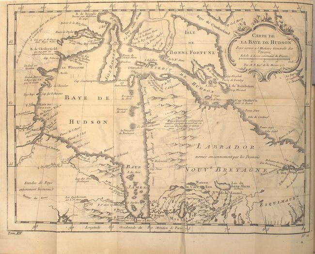
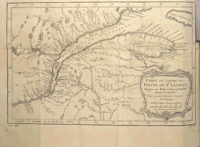
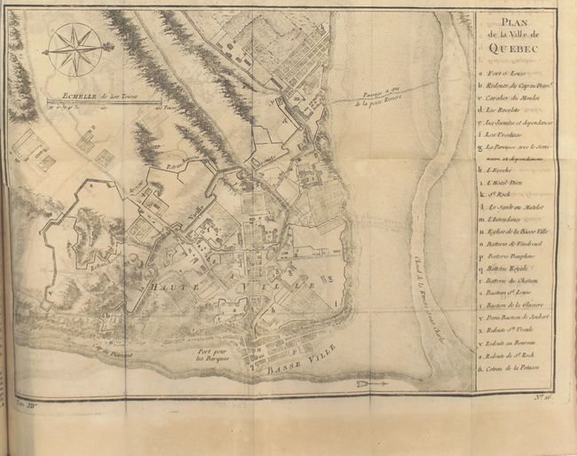
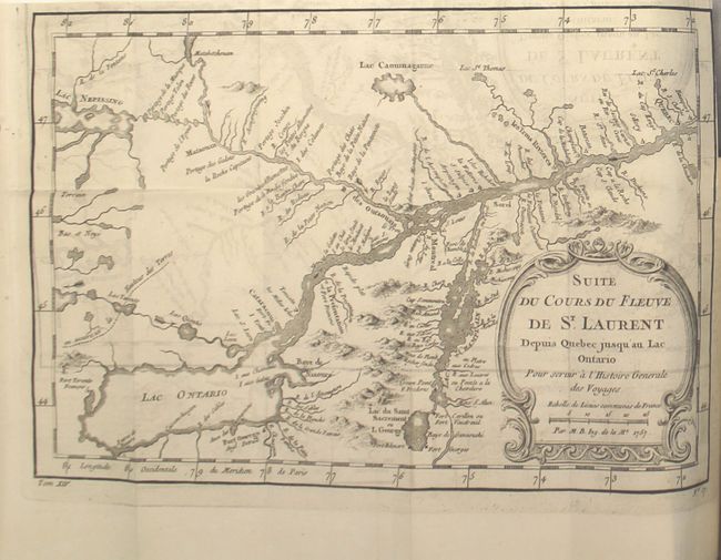
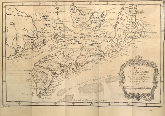
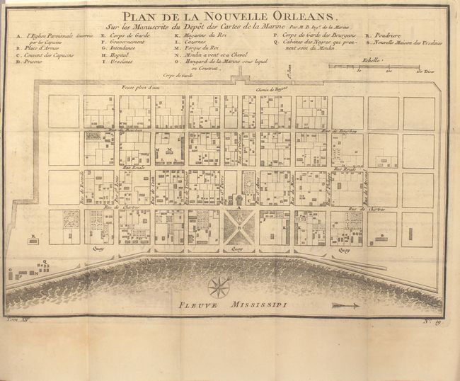
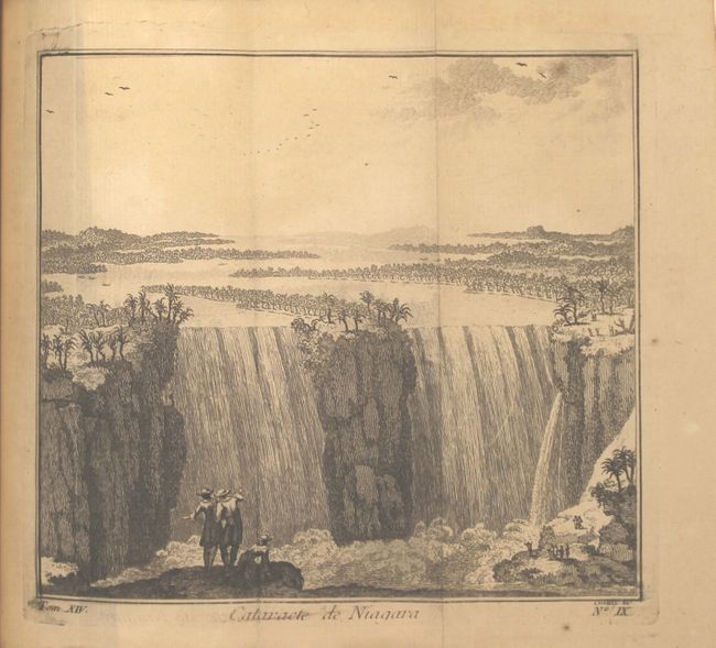
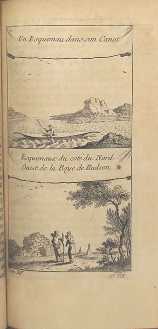
"Histoire Generale des Voiages, ou Nouvelle Collection ... Tome Cinquante-Sixieme", Prevost, Anton Francois

Subject: Exploration and Surveys, North America

Period: 1758 (published)

Publication:

Color: Black & White

Size:
4.1 x 6.8 inches
10.4 x 17.3 cm
Download High Resolution Image
(or just click on image to launch the Zoom viewer)

This is a nice example of volume fifty-six of Prevost's history of voyages, with maps by Jacques Nicolas Bellin. This is the 1758 edition, published by Firmin Didot in Paris. The focus of this volume is Canada and the United States, and includes seven fold-out maps and two engravings:

A. Carte des Lacs du Canada. This is an excellent French & Indian War period map depicting the five Great Lakes. While this map uses the same title as Bellin's prototype map of the Great Lakes, published in Charlevoix’s Histoire et Description Generale de la Nouvelle France in 1744, it has been updated with information from Bellin's similar map of 1755. Lakes Erie and Ontario are more accurately defined and the spurious islands in Lake Huron have been eliminated. However, several large, bogus islands still remain in Lake Superior, including I. Minong (called I. Philippeaux on some issues) and I. Pontchartrain. The Michigan peninsula is still misshapen with a massive mountain range down its center. Numerous forts are located: S. Jgnace, Niagara, des Miamis, and Toronto to mention a few.

B. Carte de la Baye de Hudson. This chart of the Hudson Bay and Labrador depicts the mountains and coastal features and includes numerous forts. There is a note in French in the far northwest corner of the map explaining that the English had searched for a Northwest Passage in that region, but it did not exist.

C. Carte du Cours du Fleuve de St. Laurent Depuis son Embouchure Jusqu'au Dessus de Quebec. This map details the course of the St. Lawrence River from Anticosti Island and the mouth west to beyond Quebec. It details many rocks and shoals in the river with numerous villages and forts located along the shore.

D. Plan de la Ville de Quebec. This attractive and historical map of Quebec presents the city as it would have appeared when the French surrendered at the end of the French and Indian War. It is based on earlier plans by Bellin, first published in 1744, that continued to be the definitive view for many years. The list at right names and keys 24 buildings, batteries, and forts; it locates Fort S. Louis, the Hotel Dieu, and St. Roch. The map locates Ancient retrenchment, the high village, and more. This terrific plan is oriented with north to the right as indicated by a decorative compass rose with fleur-de-lys.

E. Suite du Cours du Fleuve de St. Laurent Depuis Quebec Jusqu au Lac Ontario. A detailed map of the region between Lake Ontario and the St. Lawrence River to Quebec. The map extends to Lake Champlain and Lake George, as well as Lake Nepessing in Michigan, with numerous portages named on the interconnecting waterways. Locates Montreal. There are a number of forts named, including Ft. Toronto, Ft. Oswego, and Ft. Georges.

F. Carte de l'Acadie, Isle Royale, et Pais Voisins. This map covers all of Nova Scotia including Cape Breton. Prince Edward Island, here called Isle Saint Jean, is shown in good detail, and Nova Scotia is in part named as Acadie. South of Nova Scotia numerous banks are noted where 'la Pesche est tres bonne' (the fish are very good). The Micmac tribe is named near Shelburne. This map was published shortly after the 1755 expulsion of Acadians from this region. Although the Acadians were able to come back in 1764, many had settled in Louisiana and did not return.

G. Plan de la Nouvelle Orleans. This is an attractive copper-engraved plan of the city of New Orleans that details the city center including Bourbon Street. Individual buildings are depicted and keyed to a list under the title naming 18 buildings. The plan locates the quay along the Mississippi River, the canal, government buildings, church, prison, hospital, monastery, army & navy quarters. Bellin's plan was first issued in Charlevoix's History and General Description of New France in 1742 with later versions, such as this, used in several publications. The plan became the standard map of New Orleans throughout the eighteenth century.

H. Cataracte de Niagara. This fold-out view depicts the Niagara Falls. Engraved by Chedel.

I. Un Esquimau dans son Canot / Esquimaux du Cote du Nord-Ouest de la Baye de Hudson. This full-page engraving includes a view of an "Eskimo" in a canoe and another of an "Eskimo" family with a small village in the background. Engraved by Chedel.

508 pp. 12mo, hardbound in full original leather with gilt tooling and title on red leather label on spine. Marbled end-papers.

References:

Condition:

The maps are all clean and bright with light to moderate offsetting and tiny binding tears (B/B+). The text and binding are in excellent condition (A). There is a faint damp stain in top right corner of last 20 pages of text. Covers have some abrasions and spine is cracking.

Estimate: $800 - $1,000

Sold for: $600

Closed on 9/16/2015

Archived