Catalog Archive
Auction 154, Lot 706

"Paskaart van de Kust van Maroca Beginnende van Larache, tot aan C. Cantin...", Keulen, Johannes van

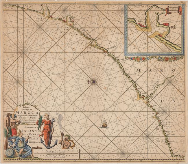
Subject: Northwestern Africa

Period: 1700 (circa)

Publication:

Color: Hand Color

Size:
22.6 x 19.8 inches
57.4 x 50.3 cm
Download High Resolution Image
(or just click on image to launch the Zoom viewer)

This beautifully engraved chart shows a stretch of the Moroccan coastline. It names several cities and rivers along the coast, and rhumb lines, soundings, anchorages, and hazards appear in the water. An inset at top right zooms in on Sale and Rabat. A ship is depicted sailing across the Atlantic, and a compass rose orients north to the left. The title and distance scales are enclosed in a vibrant decorative cartouche that features a number of allegorical figures, including Mercury and a female standing on an anchor with a bird perched upon her arm.

References:

Condition: B+

There is light scattered foxing and soiling. Two small damp stains just enter the image at the top and bottom right corners, and there is a centerfold separation that enters less than 1" into map at top.

Estimate: $240 - $300

Sold for: $130

Closed on 9/16/2015

Archived