Catalog Archive
Auction 154, Lot 648

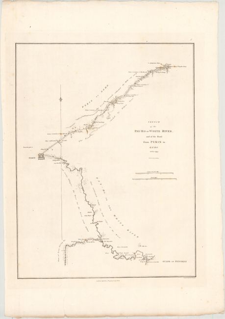
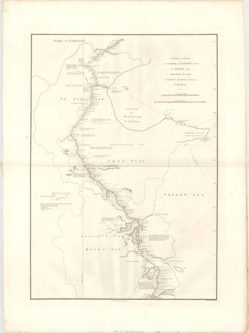
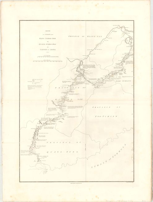
"[Lot of 3] Sketch of the Pay-Ho or White River, and of the Road from Pekin to Geho... [and] A Sketch of a Journey from Zhe-Hol in Tartary by Land to Pekin... [and] Sketch of a Journey from Hang-Tchoo-Foo to Quang-Tchoo-Foo... ", Barrow, John (Sir)

Subject: China

Period: 1796 (dated)

Publication: An Authentic Account of an Embassy from the King … to the Emperor of China

Color: Black & White

Size:
See Description
Download High Resolution Image
(or just click on image to launch the Zoom viewer)

This striking lot appeared in the account of George Macartney's travels to China, published by George Nicol. Macartney was Britain's first envoy to China, and was tasked with convincing Emperor Qianlong to ease restrictions on trade between Great Britain and China by allowing the British to have a permanent embassy in the country. All three were drawn from information supplied by John Barrow, who was the private secretary to Lord Macartney. He was later Secretary to the Admiralty and was a vice-president and founding member of the Royal Geographical Society. Published in London by George Nicol and engraved by B. Baker.

A. Sketch of the Pay-Ho or White River, and of the Road from Pekin to Geho Taken 1793, (13.3 x 17.3"). This chart shows the course of the Hai River as it flows from Peking (Beijing) to its mouth in the Gulf of Petcheli, now called the Bohai Gulf. Many notations describe the land around the river, indicating areas of "cultivated land," "rice grounds," "salt magazines," and "cut timber." The city of Peking is drawn as a fortified block, and the top half of the chart depicts the road from Peking to Geho, labeling important towns and palaces along the way. Condition: A nice impression with a few spots of foxing and an edge tear in the bottom blank margin. (A)

B. A Sketch of a Journey from Zhe-Hol in Tartary by Land to Pekin and from Thence by Water to Hang-Tchoo-Foo in China, (17.8 x 25.1"). This map follows the Grand Canal, the longest ancient canal in the world, from Hangzhou to Beijing. The official courier stations, each placed at intervals of 35 to 45 km, are noted along the route. There are extensive geographical notes as well as markers indicating bridges, temperature, towns and villages, and sluices around canals. Condition: A fine impression with faint offsetting and a few spots of foxing in the blank margins. (A)

C. Sketch of a Journey from Hang-Tchoo-Foo to Quang-Tchoo-Foo or Canton in China, (17.9 x 25.2"). This map covers the embassy's route from Hangzhou to Canton and presents an incredible amount of information, including many notes describing the landscape and the region's agriculture. Cities, towns, villages, bridges, sluices around canals, and halting places are located. Condition: A nice impression with several printer's creases and minor scattered foxing. (B+)

References: Shirley (BL Atlases) G.BARR-1a #8, #9, & #10.

Condition:

See description above.

Estimate: $450 - $550

Sold for: $325

Closed on 9/16/2015

Archived