Catalog Archive
Auction 154, Lot 456

"Pascaarte van't Schagerrack. Ende Custe van Noorwegen tot Akersondt Beschreven", Colom, Arnold

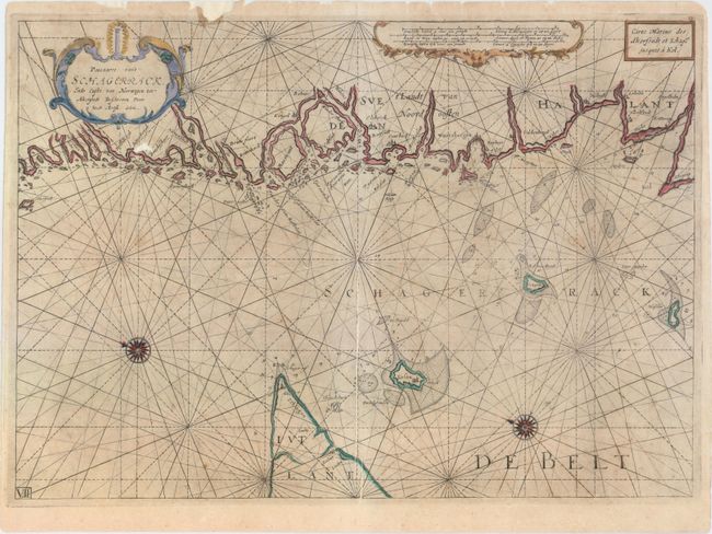
Subject: Southwestern Sweden, Skagerrak

Period: 1649 (circa)

Publication: The New Fierie Sea-Colomne...

Color: Hand Color

Size:
20.5 x 14.5 inches
52.1 x 36.8 cm
Download High Resolution Image
(or just click on image to launch the Zoom viewer)

This uncommon sea chart centers on the Skagerrak in between Jutland and the southwest coast of Sweden. Islands, soundings, anchorages, and hazards appear in the water. There are a number of place names along the coasts, including Skagen (Schagen) at the tip of the Jutland peninsula. There are two compass roses capped by fleurs-de-lis and radiating rhumb lines. North is oriented towards the left. Two decorative strapwork cartouches complete the composition at top, one containing the distance scales, the other the title.

References:

Condition: B

There are a number of professionally repaired tears and chips along the top edge of the sheet, as well as a repaired tear running horizontally through the length of the map. Two printer's creases along the centerfold have been pressed flat, exposing un-inked paper. There is light soiling and minor foxing. There is a small hole just below the title cartouche that has been professionally repaired, with a minor amount of image missing.

Estimate: $950 - $1,200

Sold for: $475

Closed on 9/16/2015

Archived