Catalog Archive
Auction 154, Lot 437

"Caernarvo Comitatus pars olim Ordovicum", Saxton/Hole
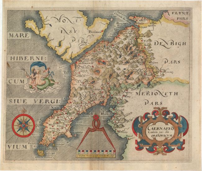
Subject: Wales

Period: 1610 (circa)

Publication: Camden's Britannia

Color: Hand Color

Size:
12 x 9.8 inches
30.5 x 24.9 cm
Download High Resolution Image
(or just click on image to launch the Zoom viewer)

This attractive map of the Caernarvon peninsula graphically depicts the rugged topography of the region and is centered on Mt. Snowdon. Locates numerous towns and villages, especially along the coastline, with forests and lakes and mountains filling the interior. The map is elaborately decorated with a scene of Neptune embracing a woman, a divider and compass rose. Saxton and Hole's imprint appears below the distance scale. Published in Camden's Britannia.

References:

Condition: B+

Attractive color on watermarked paper with two printer's creases to the right of the centerfold, minor printer's ink residue, and one small stain along the left border.

Estimate: $140 - $170

Sold for: $100

Closed on 9/16/2015

Archived