Catalog Archive
Auction 154, Lot 426
"Afteekening van het Margat, en Noord Voor Land, Digt by de Hoofden... [on sheet with] Afteekening van de Rivier Cly en Blakeny...", Keulen, Gerard van
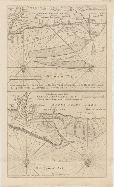
Subject: North Sea, Kent, Norfolk
Period: 1730 (circa)
Publication: De Nieuwe Groote Lichtende Zee-Fakkel...
Color: Black & White
Size:
11.6 x 19.8 inches
29.5 x 50.3 cm
Download High Resolution Image
(or just click on image to launch the Zoom viewer)
(or just click on image to launch the Zoom viewer)