Catalog Archive
Auction 154, Lot 402

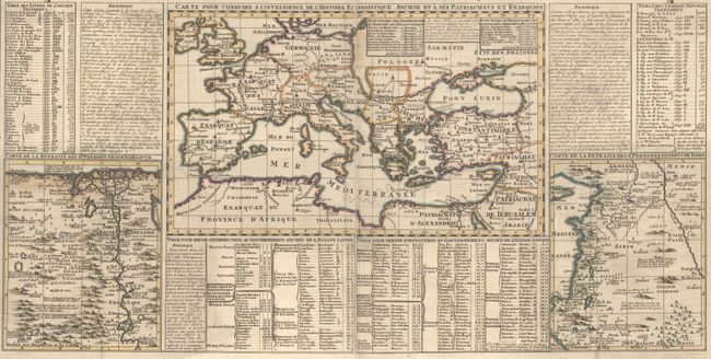
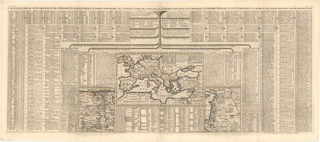
"Carte pour Servir a l'Intelligence de l'Histoire Eclessiastique & A Faire Connoitre les Persecutions de l'Eglise, les Schismes dont elle a ete Troublee...", Chatelain, Henry Abraham

Subject: Europe & Mediterranean

Period: 1719 (circa)

Publication: Atlas Historique

Color: Hand Color

Size:
47.8 x 19.1 inches
121.4 x 48.5 cm
Download High Resolution Image
(or just click on image to launch the Zoom viewer)

Very interesting large French chart illustrating the various religious divisions in Europe and the Mediterranean. At center is a map (13.5 x 8.5") of Europe with adjacent maps (5.7 x 7.2" each) of Egypt and the Holy Land. All surrounded by tables of text describing the persecutions of Christians, chronology of various kingdoms, popes, etc. On two joined sheets as issued.

References:

Condition: A

A dark impression, issued folding, with attractive color and light printer's ink residue.

Estimate: $240 - $300

Sold for: $150

Closed on 9/16/2015

Archived