Catalog Archive
Auction 154, Lot 393

"Carte Generale des Costes de l'Europe sur l'Ocean Comprises Depuis Dronthem en Norvege Jusques au Detroit de Gibraltar", Bellin, Jacques Nicolas

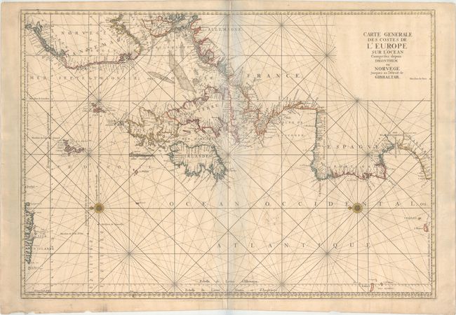
Subject: North Atlantic, Western & Northern Europe

Period: 1753 (published)

Publication: Le Neptune Francois…

Color: Hand Color

Size:
33.8 x 23.7 inches
85.9 x 60.2 cm
Download High Resolution Image
(or just click on image to launch the Zoom viewer)

This superb sea chart of the western Atlantic extends from the Barbary coast of Africa to Iceland and the Norwegian coast, thus including the whole British Isles. The chart includes a rare reference to the Kimmen Line, which indicates a depth of 100 fathoms from Denmark to just west of the Shetland Isles, north of Scotland. Rhumb lines radiate across the chart and two compass roses orient north to the left. Beautifully engraved by Herman van Loon. This example comes from the 1753 publication of Le Neptune Francois..., as indicated by the additional notes on longitude and latitude.

References: Pastoureau, NEPTUNE FRANCAIS C #1.

Condition: B+

On a sturdy watermarked sheet with minor toning, faint soiling, a couple of printer's creases along the centerfold, and a few tiny holes that are only visible when held up to light. There are manuscript notations to the right of the centerfold and a few tears in the blank margins that do not enter the map image. The bluish shadows in the image are a product of the scanning process and are not present on the map itself.

Estimate: $400 - $500

Sold for: $300

Closed on 9/16/2015

Archived