Catalog Archive
Auction 154, Lot 355

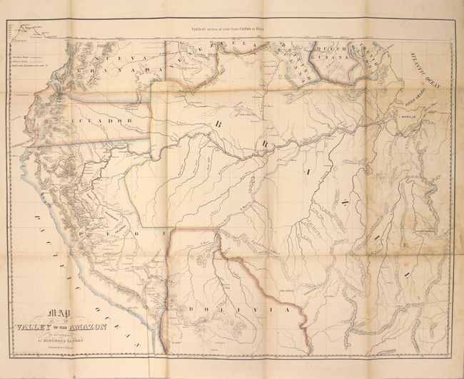
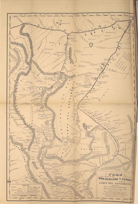
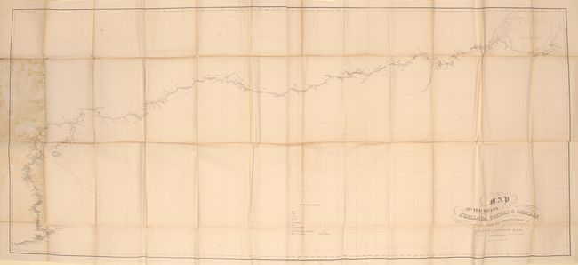
"Herndon's Valley of the Amazon Maps. Part I.", Herndon, Lt. William Lewis

Subject: Northern South America, Amazon

Period: 1853 (circa)

Publication: Sen. Ex. Doc. No. 36, 2d. Session, 32d Congress

Color:

Size:
7 x 10 inches
17.8 x 25.4 cm
Download High Resolution Image
(or just click on image to launch the Zoom viewer)

Herndon was sent to "explore the Amazon, to sound its streams and to report as to their navigability." He also was commanded to "examine its fields, its forests and its rivers that he might gauge their capabilities, active and dormant, for trade with the states of Christendom and make known to the spirit and enterprise of the age the resources which lie in concealment there waiting for the touch of civilization." This is the atlas to accompany Herndon's report (not included), containing the following three maps:

A. Map of the Valley of the Amazon, printed color (23.5 x 17.5"). This seldom seen map details the basin and valley of the Amazon River. The range extends from the Pacific in Peru and Ecuador to the Atlantic and the mouth of the Amazon at the I. Marajo. The watershed is shown in great detail. Lieutenant Herndon made this exploration and the resulting report under the direction of the U.S. Navy Department. He journeyed through parts of Peru, Bolivia and Brazil for nearly a year and went on to become the captain of the ill-fated Central America which sank in 1857 with a load of gold and newly minted gold coin from the Carson City mint. The gold, valued at more than a billion dollars, was recovered in a deep water project completed in 1989. Condition: On sturdy paper with a few small spots of foxing, a misfold at bottom, and some light staining where the map was adhered to the boards and along one fold.

B. Plan del Curso de los Rios Huallagea y Ucayali..., black & white (10.8 x 15.5"). Shows cities, towns, mountain passes, and native inhabitants. Condition: There is a 3" binding tear closed on verso with archival tape and some chipping along the right border.

C. Map of the Rivers Huallaga, Ucayali, and Amazon..., black & white (56 x 25"). Two sheets joined. Shows the path of the river system from Lake Marajo to the Pacific Ocean. The map locates hundreds of place names, forts and factories along the route. Condition: There is some staining where the map was glued to the boards, a few spots of foxing, and several tiny splits at fold intersections.

Hardbound in original brown cloth covers with decorative embossing and gilt title.

References:

Condition: B

See description above.

Estimate: $170 - $200

Sold for: $85

Closed on 9/16/2015

Archived