Catalog Archive
Auction 154, Lot 34

"Map of the World on the Mercator Projection, Exhibiting the American Continent as Its Centre", Mitchell, Samuel Augustus
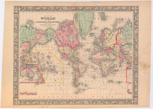
Subject: World

Period: 1860 (dated)

Publication:

Color: Hand Color

Size:
18 x 14.1 inches
45.7 x 35.8 cm
Download High Resolution Image
(or just click on image to launch the Zoom viewer)

This crisply engraved map with the Western Hemisphere at center features the tracks of several explorers including Cook, Gore, and Ross. In this first edition map, the continent of Antarctica is named, but only small portions of its coastline are delineated, naming Graham's Land, Palmer's Land, and showing the track of the U.S. Exploring Expedition. The Trans-Atlantic telegraph cable is shown between Newfoundland and Ireland. Alaska is shown here Russian Territory.

References:

Condition: B+

There is an archivally repaired centerfold separation at bottom that just enters the map border, a few tiny spots in the image, and some soiling in the right blank margin.

Estimate: $70 - $90

Sold for: $50

Closed on 9/16/2015

Archived