Catalog Archive
Auction 154, Lot 258

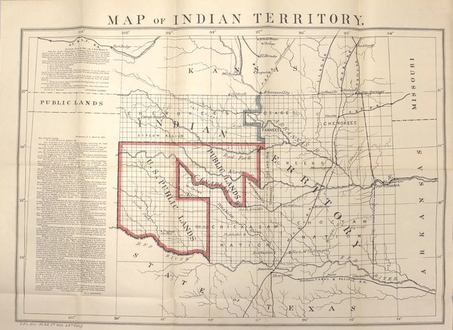
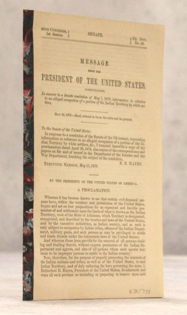
"Map of Indian Territory [with report] Message from the President of the United States…in Relation to an Alleged Occupation of a Portion of the Indian Territory by White Settlers", Boudinot, E. C.

Subject: Oklahoma

Period: 1879 (published)

Publication: Sen. Ex. Doc. No. 20, 46th Cong., 1st Sess.

Color: Printed Color

Size:
22 x 15 inches
55.9 x 38.1 cm
Download High Resolution Image
(or just click on image to launch the Zoom viewer)

A desirable map depicting the territory with the first designation of Public Lands. Included in a panel to the side of the map are two fascinating letters concerning the disposition of the Public Lands within the territory. The first, by Congressman Augustus Albert contains a list of questions. The answers, by Col. E.C. Boudinot, attempt to "set the records straight" by detailing how the land was acquired from the Indians, its current status, and directions to "several million acres of the richest land on the continent." A number of Army forts are named and located. Bound into the original 34 pp. report. A significant and important map for any Oklahoma collection.

References:

Condition: A+

Crisp, clean example.

Estimate: $275 - $350

Sold for: $180

Closed on 9/16/2015

Archived