Catalog Archive
Auction 154, Lot 253

"North Carolina from the Best Authorities", Low, E.

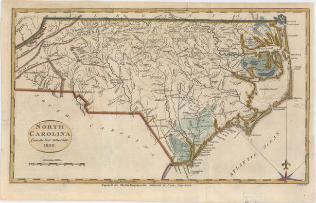
Subject: North Carolina

Period: 1800 (dated)

Publication: The New Encyclopaedia...

Color: Hand Color

Size:
12.7 x 7.4 inches
32.3 x 18.8 cm
Download High Resolution Image
(or just click on image to launch the Zoom viewer)

This is an early map of the state of North Carolina, which is a reduced version of Reid’s map of 1796. The map shows fine detail of watershed, towns, wagon roads, and mountains. There is particular emphasis on the Outer Banks. It locates Roanoke Island, Cape Fear, the Great Alligator dismal Swamp along the southern edge of the Albemarle Sound, and the Gr. Dismal Lebanon Swamp along the northern edge.

References:

Condition: B+

Issued folding, now pressed, with archival repairs to a tiny tear in the western portion of the state, a short fold separation, and a tear that enters 1" into map at bottom right.

Estimate: $240 - $300

Sold for: $150

Closed on 9/16/2015

Archived