Catalog Archive
Auction 154, Lot 250

"Map of New York and Vicinity Accompanying "Atlas of New York and Vicinity"", Beers, Ellis & Soule

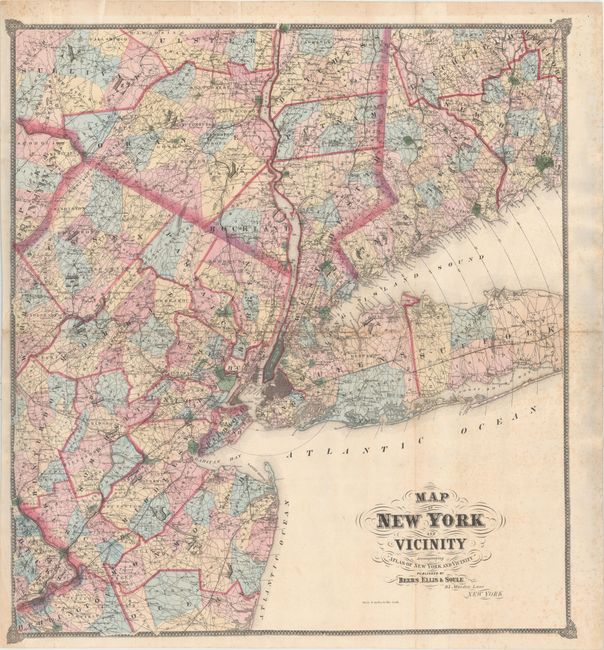
Subject: New York City, New York

Period: 1867 (circa)

Publication: Atlas of New York and Vicinity from Actual Surveys

Color: Hand Color

Size:
28 x 30.5 inches
71.1 x 77.5 cm
Download High Resolution Image
(or just click on image to launch the Zoom viewer)

This scarce, large-format map was published only once in this atlas. The colorful map shows the portion of New York State south of Poughkeepsie and most of Long Island. It also shows half of Connecticut west from New Haven, the northern half of New Jersey including Trenton and a small portion of Pennsylvania. The map presents remarkable detail of towns and villages, roads, railroads, and political boundaries including counties and townships. The cities and larger towns are drawn in street grid pattern and the detail is so good that even Central Park is named. Circles at five mile increments radiate from lower Manhattan. The map is embellished with fancy titling and flourishes, and surrounded by a decorative border.

References:

Condition: B

Strong colorful impression. The sheet is backed with Japanese tissue to repair a few fold separations. There is also some light toning along the horizontal fold and light scattered foxing primarily in the lower right, mostly blank, section of the map.

Estimate: $230 - $275

Unsold

Closed on 9/16/2015

Archived