Catalog Archive
Auction 154, Lot 222

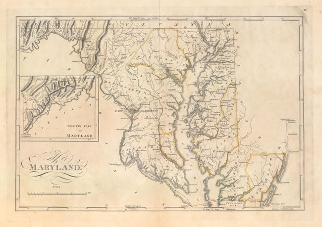
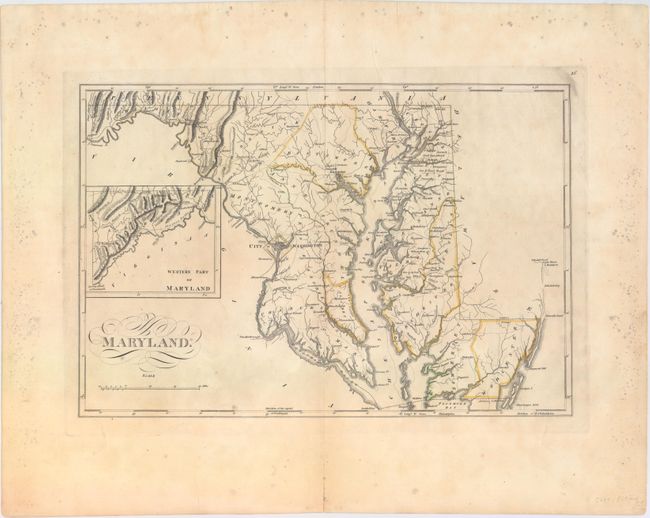
"Maryland", Carey, Mathew

Subject: Maryland

Period: 1814 (circa)

Publication: General Atlas, Improved and Enlarged

Color: Hand Color

Size:
16.6 x 11.3 inches
42.2 x 28.7 cm
Download High Resolution Image
(or just click on image to launch the Zoom viewer)

Mathew Carey was a seminal figure in early American publishing; establishing the first publishing firm to specialize in cartography and issuing the first atlas devoted exclusively to American maps. He set up an elaborate cottage system of craftsmen for compiling, engraving, printing, and coloring maps. This practice was emulated by later American cartographic publishers such as John Melish and Henry S. Tanner. The American Atlas concept was also adopted by other publishers in both the United States and Europe.

This early map of Maryland delineates counties and shows settlements and roads. A road is shown connecting Alexandria with Mount Vernon, and an inset at left depicts the "Western Part of Maryland." Only nineteen counties are shown in addition to the District of Columbia. Title in script below the inset. A fine example of this early state map.

References: Phillips (Atlases) #722-16.

Condition: B+

Original outline color and wide margins with light printer's ink residue, a faint damp stain along the centerfold at bottom, and archivally repaired centerfold separations confined to the top and bottom blank margins. There are scattered mildew stains along the edges of the sheet, not affecting image.

Estimate: $500 - $650

Unsold

Closed on 9/16/2015

Archived