Catalog Archive
Auction 154, Lot 208

"Preliminary Chart of St. Mark's River Florida from a Trigonometrical Survey...", U.S. Coast Survey

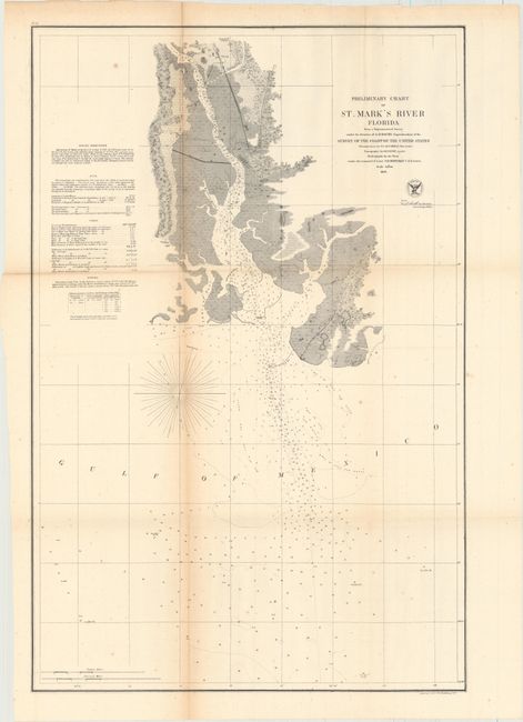
Subject: Northwestern Florida

Period: 1856 (dated)

Publication:

Color: Black & White

Size:
17.8 x 27 inches
45.2 x 68.6 cm
Download High Resolution Image
(or just click on image to launch the Zoom viewer)

The Office of Coast Survey is the oldest U.S. scientific organization, dating from 1807 when Congress directed that a "survey of the coast" be carried out. By 1836, it was called the U.S. Coast Survey and in 1878, the name was changed to the U.S. Coast and Geodetic Survey. Today the Office of Coast Survey is a division of the National Oceanic and Atmospheric Administration NOAA.

The survey teams, composed of civilians as well as Army and Naval officers, charted the nation's waterways and produced a wide array of reports, survey charts, hydrographic studies of tides and currents, astronomical studies and observations, and coastal pilots. These charts are an important record of the changing nature of the nation's coastlines. In additional to coastal charts, the U.S. Coast and Geodetic Survey produced land sketches, Civil War battle maps, and the early aeronautical charts.

This chart centers on the mouth of the St. Marks River along the Gulf of Mexico. It is dense with information, including depth soundings, bottom type, sailing directions, bayous, information on the tides, and more. The town of St. Marks is depicted in miniature plan form, and a note refers to the destruction of Port Leon in 1848.

References:

Condition: B+

A crisp impression, issued folding, with light toning along one fold, minor scattered foxing, and one tiny hole at a fold intersection that has been closed on verso with archival tape.

Estimate: $110 - $150

Unsold

Closed on 9/16/2015

Archived