Catalog Archive
Auction 154, Lot 204

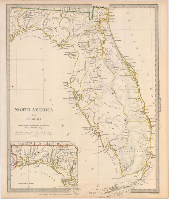
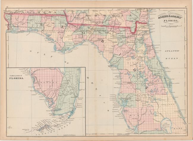
"[Lot of 2] North America XIV Florida [and] Asher & Adams' Florida",

Subject: Florida

Period: 1834-74 (dated)

Publication:

Color: Hand Color

Size:
See Description
Download High Resolution Image
(or just click on image to launch the Zoom viewer)

A. North America XIV Florida, by Society for the Diffusion of Useful Knowledge, dated 1834 (12.3 x 15.8"). Early and very detailed, steel engraved map of Florida that was published eleven years before statehood. The western panhandle, from Apalachicola to the Perdido River, is shown in an inset on the same scale. South Florida is virtually empty of settlement, but is bisected by a long Indian Path. A large reservation for the Seminole Indians takes in much of the interior of the peninsula and the region around Charlotte Harbor. Lake Okeechobee (here Lake Macaco) is incorrectly located, which is a common error on maps of this period because the region was largely unexplored. The first railroad was chartered three years before this map was issued, but we find no mention of it here. An early map of Florida, published by Baldwin & Cradock. Condition: A bright example with original outline color, one tiny spot of ink, and faint toning along the edges of the sheet. (A)

B. Asher & Adams' Florida, by Asher & Adams, dated 1874 (23.4 x 15.9"). Colored by county, the map shows the evolving railroad network, cities and towns, canals and drainage. An inset of the southern portion of the state at bottom left includes a "contemplated extension" of the South Florida Railroad to Fort Poinsett. Condition: Original color with faint offsetting in the image and minor toning along edges of the sheet. (B+)

References:

Condition:

See description above.

Estimate: $325 - $400

Sold for: $230

Closed on 9/16/2015

Archived