Catalog Archive
Auction 154, Lot 173

NO RESERVE

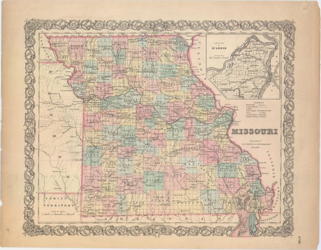
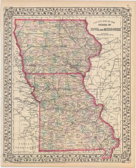
"[Lot of 2] Missouri [and] County Map of the States of Iowa and Missouri",

Subject: Central United States

Period: 1855-72 (dated)

Publication:

Color: Hand Color

Size:
See Description
Download High Resolution Image
(or just click on image to launch the Zoom viewer)

A. Missouri, by J.H. Colton & Co., dated 1855 (15.9 x 12.8"). This detailed map of Missouri features good detail of county lines, roads, canals, rivers, and railroads. It shows the Pacific Railroad on a stretch from Jefferson City to St. Louis along with numerous other railroads. An inset at top right centers on St. Louis. The boot is included on the map, rather than as an inset. A part of the Kansas Territory appears as Kanzas with plenty of Indian tribes named. Condition: Minor soiling with light toning along the sheet edges.

B. County Map of the States of Iowa and Missouri, by Samuel Augustus Mitchell, from Mitchell's New General Atlas, dated 1872 (11.8 x 14.3"). This political map includes some geographical detail and several roads and railroads. In Iowa, county configuration is current up to 1870, with Crocker County formed but not yet absorbed back into Kossuth. Missouri's counties are accurate to 1869, as Texas County has not expanded into Douglas yet. The map includes a floral border. Drawn and engraved by W.H. Gamble. Condition: Faint scattered foxing.

References:

Condition: B+

See description above.

Estimate: $100 - $130

Sold for: $8

Closed on 9/16/2015

Archived