Catalog Archive
Auction 154, Lot 167

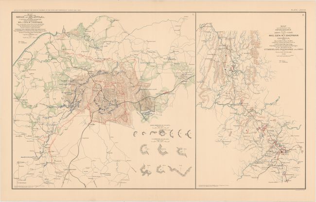
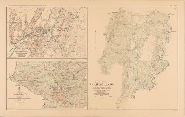
"[Lot of 2] Map Illustrating the Siege of Atlanta, GA... [and] Map Illustrating the Operations of the Army Under Com'd of Maj. Gen. W.T. Sherman in Georgia... [and] Battle-Field of Chickamauga... [on sheet with] ... Chattanooga... [and] ... Cold Harbor...", U.S. War Department

Subject: Southern United States, Civil War

Period: 1891-95 (published)

Publication: Atlas to Accompany the Official Records of the Union and Confederate Armies...

Color: Printed Color

Size:
27.3 x 16.4 inches
69.3 x 41.7 cm
Download High Resolution Image
(or just click on image to launch the Zoom viewer)

This lot of informative Civil War maps comes from the government's comprehensive atlas covering the War Between the States. These plates were issued between 1891 and 1895 to accompany the Official Army Records and were published under the Secretaries of War Redfield Proctor, Stephen B. Elkins, and Daniel S. Lamont by Maj. Gen. George B. Davis, assisted by civilian experts Leslie Perry and Joseph Kirkley. The first sheet features two maps focused on the operations of General William Tecumseh Sherman in Georgia. At left is a map detailing the crucial battle and siege of Atlanta. The map at right follows Sherman's operations from the months leading up to the battle to the days following the city's fall. The second sheet includes three maps: the first tracking the movements of the Union army around Chattanooga, TN, in January 1864; the second showing the bloody Battle of Cold Harbor, VA, in the summer of 1864; and the third and largest covering the battlefield in Chickamauga, GA.

A. Map Illustrating the Siege of Atlanta, GA.... Condition: Minor color offsetting. (A)
B. Battle-Field of Chickamauga, GA.... Condition: On a lightly toned sheet with minor color offsetting and two short tears across the centerfold. (B+)

References:

Condition:

See description above.

Estimate: $200 - $230

Sold for: $150

Closed on 9/16/2015

Archived