Catalog Archive
Auction 154, Lot 145

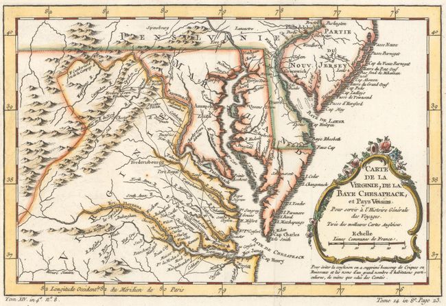
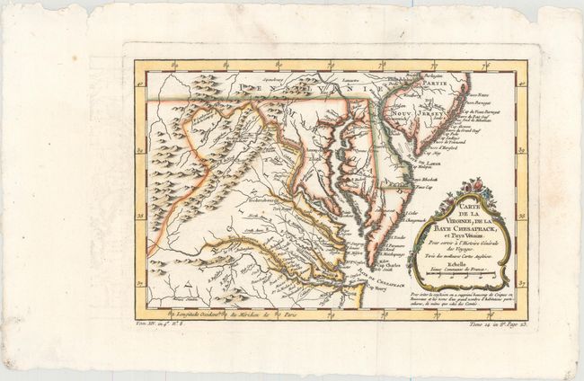
"Carte de la Virginie, de la Baye Chesapeack, et Pays Voisins", Bellin, Jacques Nicolas

Subject: Colonial Mid-Atlantic United States

Period: 1757 (circa)

Publication: La Harpe's Histoire Generale des Voyages

Color: Hand Color

Size:
11.4 x 7.6 inches
29 x 19.3 cm
Download High Resolution Image
(or just click on image to launch the Zoom viewer)

Finely engraved colonial map covering most of Virginia, Maryland, Delaware with a bit of Pennsylvania and New Jersey. The interior is fully engraved with mountains and great detail along the rivers. An early network of trails and wagon roads connects the communities along the seaboard and stretches as far west as Frederic Town ou Winchester, with one road continuing further southwest. Fort Cumberland, Bukingham, and many frontier villages are located. A delicate rococo-style title cartouche completes the composition.

References: Tooley (MCC-96) #875; cf. Sellers & Van Ee #1383.

Condition: A

A crisp impression with minor soiling and small chips and tears along the edges, well away from image.

Estimate: $275 - $350

Sold for: $210

Closed on 9/16/2015

Archived