Catalog Archive
Auction 154, Lot 104

Unique Map Depicting Both Franklinia and Morgania

"America", Stansbury, A. J.

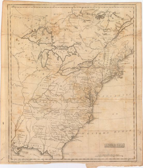
Subject: Eastern United States & Canada

Period: 1805 (circa)

Publication:

Color: Black & White

Size:
13 x 15.9 inches
33 x 40.4 cm
Download High Resolution Image
(or just click on image to launch the Zoom viewer)

This fascinating map of the Eastern United States and Canada features the short-lived states of Franklinia in eastern Tennessee (here labeled Tennassee) as well as Morgania in present-day Missouri. The latter was named after George Morgan, a land speculator, who attempted to create a new colony in the then Spanish controlled Louisiana Territory near New Madrid (Morgan gave up this endeavor a few years later). The Ohio Company land grant still appears north of the Ohio River, and Florida is divided between East and West. West of the Appalachians, detail is mostly limited to forts and the locations of numerous Indian tribes. Engraved by Scoles.

References: Old World Auctions - State of Franklin Maps #21.

Condition: B

Issued folding with light to moderate offsetting and a short binding tear at bottom closed on verso with archival tape.

Estimate: $400 - $500

Sold for: $650

Closed on 9/16/2015

Archived