Catalog Archive
Auction 153, Lot 9

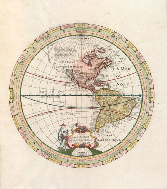
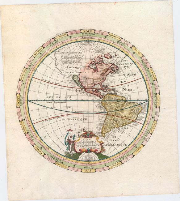
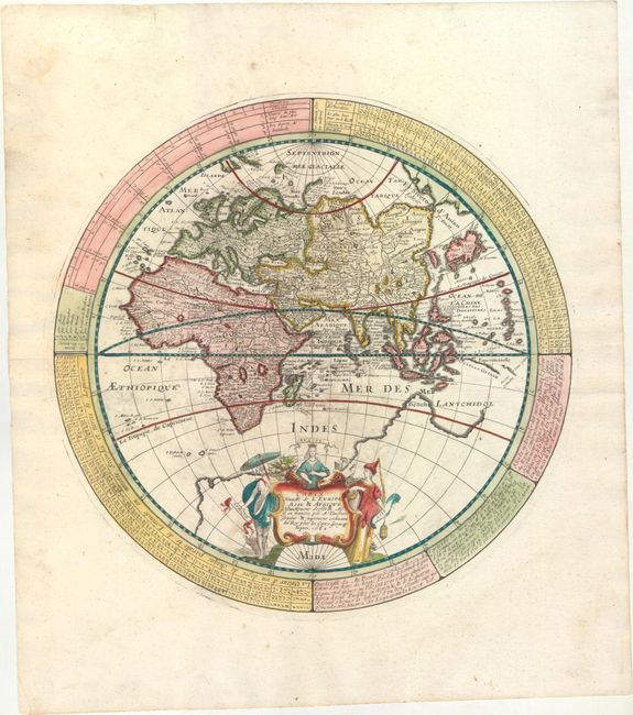
Elegant World Map in Two Separate Hemispheres

"[Lot of 2] Carte de l'Amerique Nouvellement Dressee Suivant les Nouvelles Descouvertes... [and] Carte Nouvelle de l'Europe Asie & Afrique...", Tavernier, Melchior

Subject: World

Period: 1661 (dated)

Publication:

Color: Hand Color

Size:
11.8 x 11.8 inches
30 x 30 cm
Download High Resolution Image
(or just click on image to launch the Zoom viewer)

Fine, matched pair of hemisphere maps. The Western Hemisphere shows California as an island, a single Great Lake, and an expansive northwest coastline in North America. A notation describes Thomas Button's search for a Northwest Passage. In South America, there is a small Lake Parime in Guiana, and both the Amazon and Rio de la Plata flow from the large interior Lago de los Xarayes. In the Eastern Hemisphere, the large mythical southern continent fills the bottom of the map and the Dutch discoveries in Australia are not shown. Both hemispheres are enclosed in concentric circles giving compass points, notations and tables, and each is embellished with a beautiful cartouche featuring the female representations of the continents. These two hemisphere maps first appeared in 1639, printed on a single sheet as a double hemisphere map. In this addition, not noted by Shirley, each hemisphere is printed on a separate sheet.

References: Shirley #349; Burden #255.

Condition: A

Fine impressions and color on watermarked paper with wide margins. There are a couple of faint spots on the Eastern Hemisphere map.

Estimate: $3,000 - $3,750

Unsold

Closed on 5/20/2015

Archived