Catalog Archive
Auction 153, Lot 776

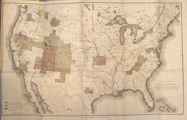
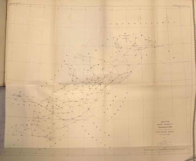
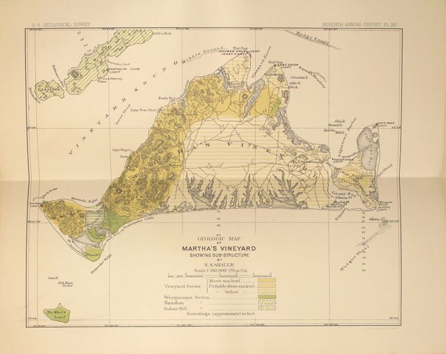
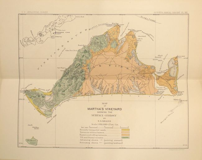
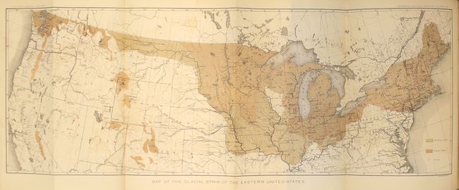
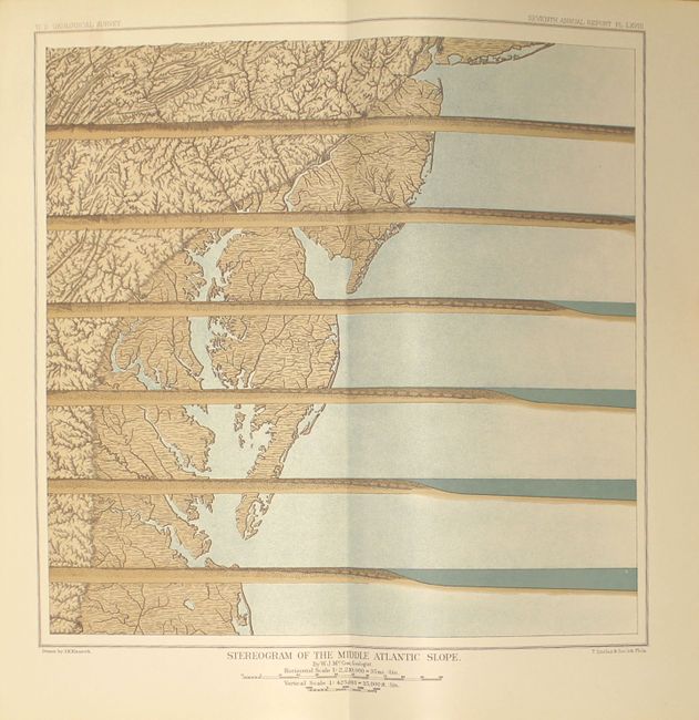
"[Seventh Annual Report of the United States Geological Survey]", Powell, John Wesley

Subject: Exploration & Surveys

Period: 1888 (published)

Publication:

Color: Printed Color

Size:
7.9 x 11.5 inches
20.1 x 29.2 cm
Download High Resolution Image
(or just click on image to launch the Zoom viewer)

This comprehensive report by the Director of the United States Geological Survey describes all progress and discoveries made during the fiscal year ending June 30th, 1886. The contents include the report of the Director, administrative reports from the division heads, and accompanying papers including: "The Rock-Scorings of the Great Ice Invasions" by T.C. Chamberlin; "Obsidian Cliff, Yellowstone National Park" by Joseph Iddings; "Report on the Geology of Martha’s Vineyard" by Nathaniel Shaler; "On the Classification of the Early Cambrian and Pre-Cambrian Formations" by R.D. Irving; "The Structure of the Triassic Formation of the Connecticut Valley" by William Morris Davis; "Salt-Making Processes in the United States" by Thomas Chatard; and "The Geology of the Head of the Chesapeake Bay" by William McGee.

In addition to the 656 pages of text are 2 large folding maps at the back of the volume, 69 plates, and numerous in-text illustrations. The folding maps are:

A. Map of the United States Showing Progress in Preparation and Engraving of Topographic Maps (27.6 x 17.3"). Depicts the extent of surveying in the United States at the close of the fiscal year 1886. Surveyed areas include the southern Appalachians, the Great Basin, California and Washington state. Condition: Light offsetting and minor scattered foxing.

B. Sketch Showing Progress of Triangulation in the Appalachian Region (23.7 x 19.0"). Map covers the region from central Alabama and Georgia north to Washington D.C., following the Appalachian mountains. Depicts the surveying work by both the Coast & Geodetic Survey and the Geological Survey. Condition: Minor toning and a few minor spots in the image, else fine.

Of particular interest among the other 69 plates are 2 hand-colored maps of Martha’s Vineyard (each 8.6 x 6.8") depicting the surface geology and sub-structure by N.S. Shaler.

Hardbound in quarter calf and tips over maroon cloth with gilt title and raised bands on spine. This example, with presentation binding, was given to Representative Ira Davenport of New York, with his name in gilt at the base of the spine.

References:

Condition: B+

See above for map condition statements. Text and other plates are near fine with some light toning along the sheet edges of the text and an occasional spot of foxing. Covers and spine are very good with light shelf wear.

Estimate: $275 - $350

Unsold

Closed on 5/20/2015

Archived