Catalog Archive
Auction 153, Lot 712

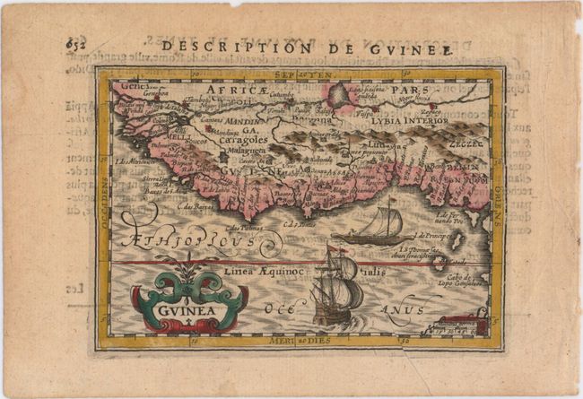
"Guinea", Hondius/Bertius
Subject: Western Africa

Period: 1616 (circa)

Publication: Tabularum Geographicarum Contractarum…

Color: Hand Color

Size:
5.2 x 3.6 inches
13.2 x 9.1 cm
Download High Resolution Image
(or just click on image to launch the Zoom viewer)

A handsome miniature map of western Africa from approximately Senegal to Nigeria. Just below the equator, Cape Lopez juts out from Central Africa. The Niger River is prominently shown along the top of the map, with a large lake. The map is handsomely adorned with a strapwork cartouche and two sailing ships. French text on verso.

References: King (2nd ed.) pp. 96-99; Van der Krogt (Vol. III) #8700:342.

Condition: B+

A fine impression and attractive color with several printer's creases in the image.

Estimate: $90 - $110

Unsold

Closed on 5/20/2015

Archived