Catalog Archive
Auction 153, Lot 643

"Tabula Geodoborica Itinerum a Varijs in Cataium Susceptorum Rationem Exhibens", Kircher, Athanasius
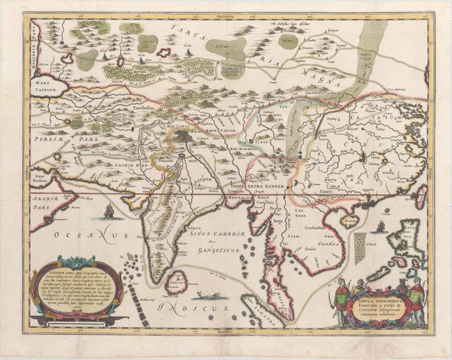
Subject: Asia

Period: 1667 (circa)

Publication: China Illustrata

Color: Hand Color

Size:
20.9 x 16.5 inches
53.1 x 41.9 cm
Download High Resolution Image
(or just click on image to launch the Zoom viewer)

This fascinating and uncommon map of Asia depicts the land and sea routes from the Middle East to China and northern Asia. Roads, towns, rivers, lakes, and mountains are all depicted graphically. The outlines of the Philippines and Southeast Asia are still quite rudimentary. Couchinchina is labeled in northern Vietnam, and Pegu Regn (now Bago, Burma) is shown south of Camboia (Cambodia). Lao Regn. is also located. Embellished with two strapwork cartouches and Chinese merchants. This map appeared in Kircher's China Monumentis, also known as China Illustrata, which was published in Latin, Dutch and French editions.

References:

Condition: B+

A crisp impression with attractive color. Issued folding with professional repairs to several fold separations, a tear that extends 4" into map from bottom center, and several large worm tracks confined to bottom blank margin.

Estimate: $500 - $650

Sold for: $400

Closed on 5/20/2015

Archived