Catalog Archive
Auction 153, Lot 554

"European Dominions of the Ottomans, or Turkey in Europe", Faden, William

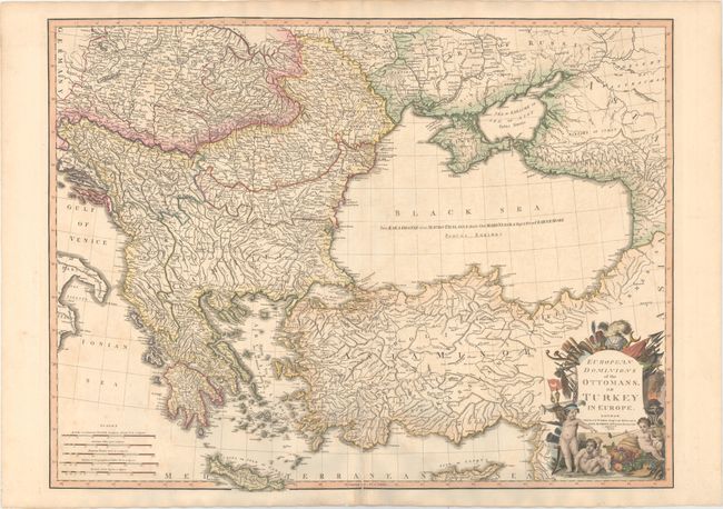
Subject: Black Sea, Balkans & Turkey

Period: 1795 (dated)

Publication:

Color: Hand Color

Size:
28.8 x 21.9 inches
73.2 x 55.6 cm
Download High Resolution Image
(or just click on image to launch the Zoom viewer)

This large, bold map takes in all of the Balkan Peninsula, the southern parts of the Ukraine and Russia, all of the Black Sea, and Asia Minor. It is filled with detail including roads connecting major cities. An extensive mileage scale is given in the lower left corner of the map. The title cartouche provides a stark contrast between the cherubic figures at its foot and the implements of war at top. This is the first state, which was later re-issued by James Wyld with additions.

References: Shirley (BL Atlases) T.FAD-4a #36.

Condition: B+

A nice impression on sturdy paper with a "Smith" watermark. Original color in the map with later coloring in the cartouche. There is very light offsetting and a centerfold separation that enters 4.5" into map at bottom that has been closed on verso with archival material.

Estimate: $275 - $350

Sold for: $200

Closed on 5/20/2015

Archived