Catalog Archive
Auction 153, Lot 553

"Nieuwe Kaert vande Omtrek der Swarte Zee uyt Verscheydene Stucken van die Gewesten Toegesonden, Ontworpen", Witsen, Nicolaas
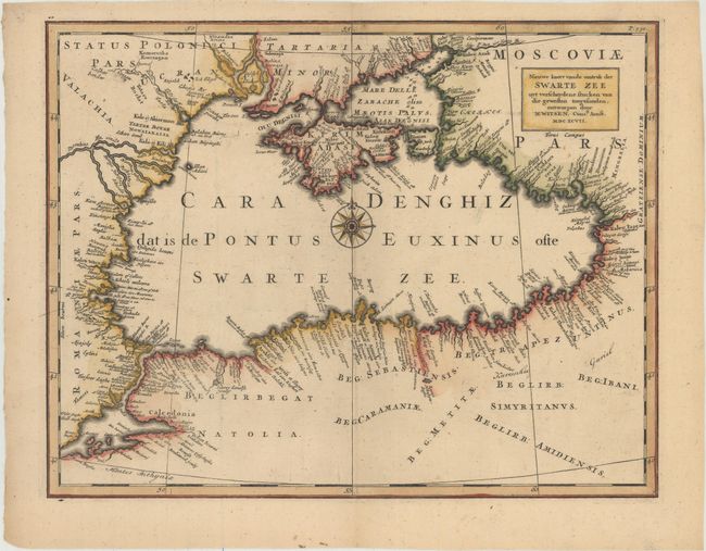
Subject: Black Sea

Period: 1697 (dated)

Publication: Noord en Oost Tartarye

Color: Hand Color

Size:
14.1 x 11 inches
35.8 x 27.9 cm
Download High Resolution Image
(or just click on image to launch the Zoom viewer)

Nicolaas Witsen (1641-1717) was a Dutchman who was a cartographer, authority on shipbuilding, administrator of the VOC, and served as mayor of Amsterdam multiple times. Witsen traveled to Moscow in 1664-65, keeping a diary and collecting artifacts. He became fascinated about Russia and obtained all information available at the time on the subject, including maps, travelogues, manuscripts and objects. In 1692, Witsen published the most comprehensive and authoritative work on Russia and northern Asia, Noord en Oost Tartarye. A second expanded edition was published in 1705 with additional maps, and again reprinted in 1785. All editions are very rare.

Witsen's map of the Black Sea is by far the most up-to-date map of the region at the time. The shapes of the Black Sea, Sea of Azov, Crimea, and Sea of Marmara are more accurate than on any other map at the end of the 17th century. The coastlines are filled with place names, and the numerous rivers that empty into the Black Sea are identified. Centered on a decorative compass rose.

References:

Condition: A

Excellent impression and color with a "Pro Propria" watermark.

Estimate: $350 - $425

Sold for: $325

Closed on 5/20/2015

Archived