Catalog Archive
Auction 153, Lot 461

Speed's Carte-a-Figures Map of England and Wales

"The Kingdome of England", Speed, John

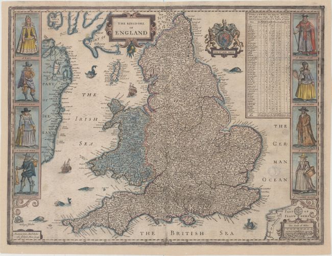
Subject: England & Wales

Period: 1646 (dated)

Publication: A Prospect of the Most Famous Parts of the World

Color: Hand Color

Size:
20.2 x 15.3 inches
51.3 x 38.9 cm
Download High Resolution Image
(or just click on image to launch the Zoom viewer)

This is Speed's handsome carte-a-figures map of England and Wales, filled with details of towns and counties. The map is flanked by male and female pairs, including a lady and nobleman, a gentleman and gentlewoman, a citizen and his wife, and a countryman and his wife. At top right is a table indicating the number of cities, bishoprics, markets, rivers, bridges, etc. in each shire. The map is embellished with two strapwork cartouches, the Royal coat of arms, and several sea monsters and galleons. Engraved by Abraham Goos and published by Bassett and Chiswell in the last edition of the Prospect.

References: Shirley (BL Atlases) T.SPE-2f.

Condition: B+

A nice impression on watermarked paper with several light stains and a number of short tears in the image that have been professionally repaired. Professionally remargined at left, and the margins at right and bottom have been extended to accommodate framing.

Estimate: $1,800 - $2,100

Sold for: $1,800

Closed on 5/20/2015

Archived