Catalog Archive
Auction 153, Lot 452

NO RESERVE

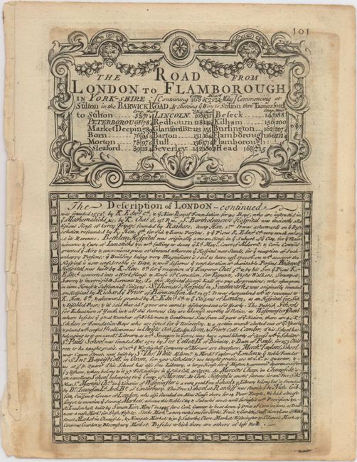
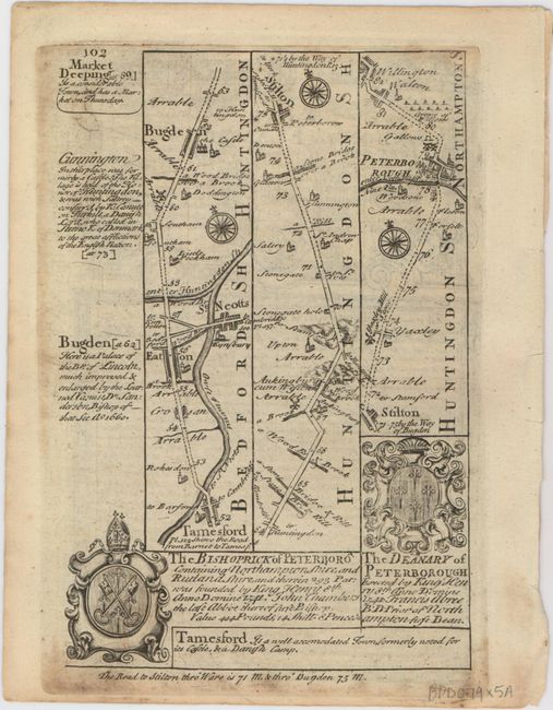
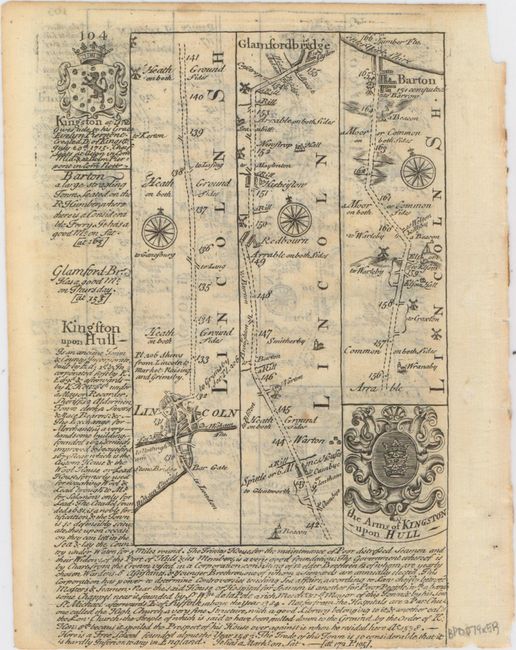
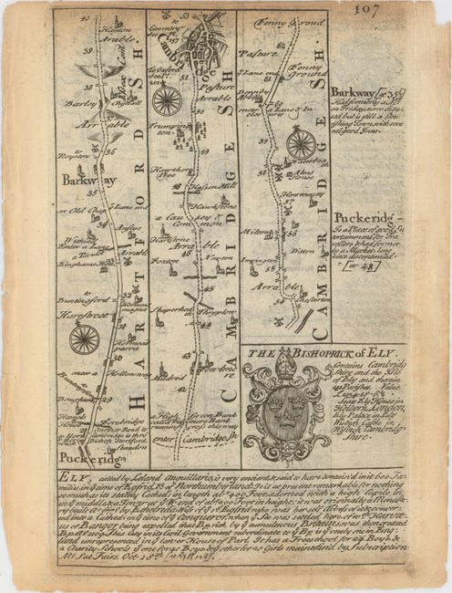
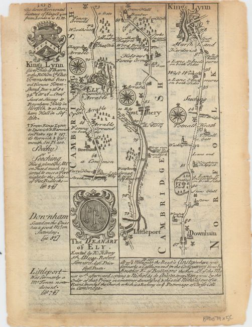
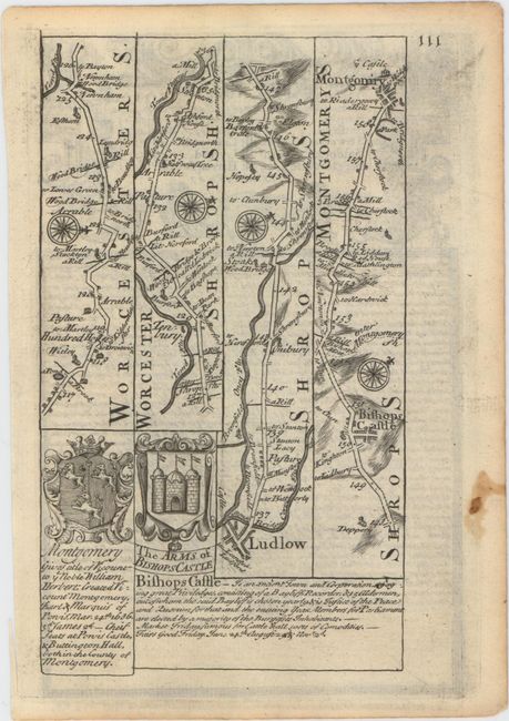
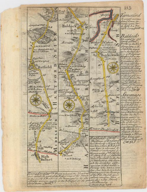
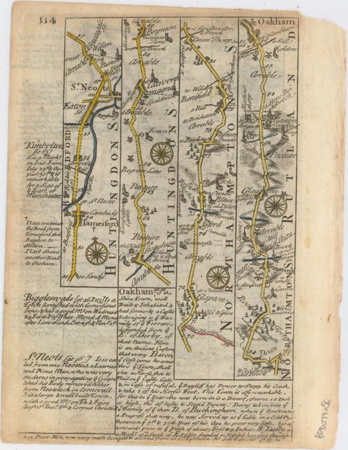
"[Lot of 5 - Road Maps]", Owen & Bowen

Subject: England

Period: 1720 (circa)

Publication: Britannia Depicta...

Color: Black & White

Size:
6.1 x 7.9 inches
15.5 x 20.1 cm
Download High Resolution Image
(or just click on image to launch the Zoom viewer)

Britannia Depicta Or Ogilby Improv'd was the most popular and successful Ogilby derivative atlas, published in response to public demand for a small road atlas that could be easily carried by travelers. The atlas reproduced Ogilby's strip-style road maps and added individual county maps. It was published by Thomas Bowles in a series of editions between 1720 and 1764. The historical notes that accompany each map were compiled by John Owen, a respected lawyer and antiquarian. The maps were engraved by Emanuel Bowen who went on to become one of London's leading engravers and print sellers in the 18th century. The maps are embellished with coats of arms and contain immense detail and topographical information. A compass rose orients each map and useful landmarks include hills, bridges, rivers and streams, windmills, churches, markets, parks and forests, water wells and even gallows.

This lot of copper engraved, Ogilby-style strip road maps includes coats-of-arms and descriptive text by John Owen. The first two sheets comprise all but the last page of The Road from London to Flamborough..., showing the title, descriptive text about London by Owen, and a road map spanning from Bedfordshire through Huntingdonshire (now part of Cambridgeshire) and Northamptonshire into the small town of Barton-upon-Humber in Lincolnshire. The third sheet consists of pages 107 and 108 from The Road from London to Kings Lyn... // A Map of Cambridgeshire, with a road map extending from Puckeridge in East Hertfordshire through the city of Cambridge to the sea port King's Lynn in Norfolk. The last two sheets include the final page of The Road from London to Montgomery Commencing at 4 Shire Stone... // Merionethshire, which features a stretch of road from Worcestershire to the city of Montgomery, as well as the entirety of The Road from London to St. Neots..., including the title, text, and a road map that begins at High Barnet in northern London and finishes nearly 90 miles away in Oakham, the county town of Rutland. The last sheet is in color. Size varies slightly.

A. [The Road from London to Flamborough...]
B. [The Road from London to Flamborough...]
C. [The Road from London to Kings Lyn... // A Map of Cambridgeshire]
D. [The Road from London to Montgomery Commencing at 4 Shire Stone... // Merionethshire] [on verso] The Road from London to St. Neots...
E. The Road from London to St. Neots..., hand color.

References: Shirley (BL Atlases) T.BOW-1a.

Condition: B+

Dark impressions with light soiling, occasional light toning along the top edges of the sheets, and a few edge chips and tears confined to the blank margins.

Estimate: $140 - $170

Unsold

Closed on 5/20/2015

Archived