Catalog Archive
Auction 153, Lot 445

"Pascaart Vant Canaal Tusschen Engelant en Vrancryck…Tabula Hydographica Freti seu Canalis…", Jansson, Jan
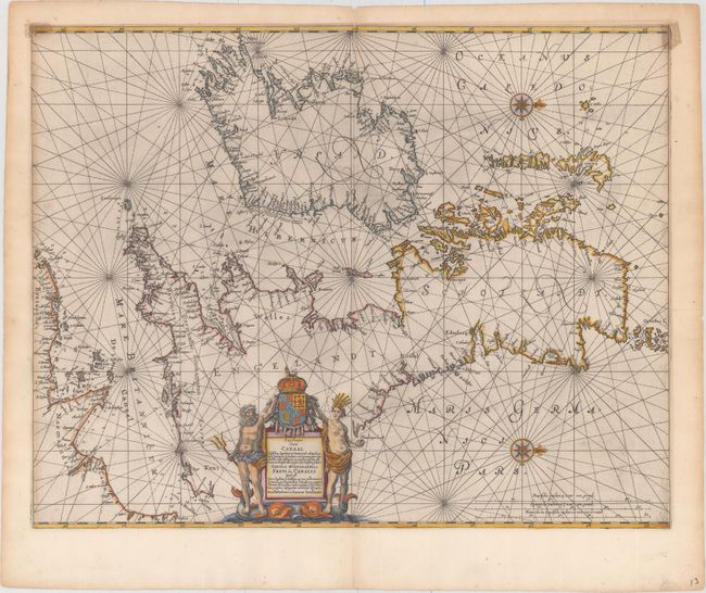
Subject: Britain

Period: 1680 (circa)

Publication: Atlas Novus

Color: Hand Color

Size:
22 x 17.25 inches
55.9 x 43.8 cm
Download High Resolution Image
(or just click on image to launch the Zoom viewer)

Rare and elegantly engraved chart of the British Isles and English Channel, based on a chart by Anthony Jacobsz from 1644. Place names are confined to the coastlines, and soundings, rocks, shoals, and other navigational information are included. Two decorative compass roses orient north to the right. The title cartouche is flanked by two ancient Britons, who stand upon sea monsters and hold the royal coat of arms. Blank verso.

References: Shirley (BI to 1650) #659; Shirley (BI to 1750) Jansson 1; Van der Krogt (Vol. I) #0130:1.

Condition: B+

A fine impression with attractive color, a centerfold separation at top that extends 2" into the image that has been closed on verso with paper tape. There are small stains in the top corners of the map image that were caused by cello tape on the verso.

Estimate: $600 - $750

Sold for: $350

Closed on 5/20/2015

Archived