Catalog Archive
Auction 153, Lot 414

"Littora Brasiliae / Pascaert van Brasil", Renard/De Wit
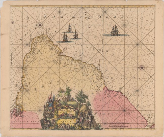
Subject: Brazil

Period: 1715 (published)

Publication: Atlas de la Navigation et du Commerce…

Color: Hand Color

Size:
22.3 x 19.1 inches
56.6 x 48.5 cm
Download High Resolution Image
(or just click on image to launch the Zoom viewer)

This magnificent map of Brazil is primarily a sea chart with details confined to the coastline. Oriented with north to the left by two fine compass roses, it covers the Brazilian coastline from the mouth of the Amazon to the Rio de la Plata in what is now Argentina. A dramatic title cartouche that fills the interior is constructed of a montage of scenes showing Portuguese and Dutch explorers and missionaries, an Indian ceremony, mining, exotic animals and produce, etc. Rhumb lines cross the entire map, which is further embellished by four sailing ships. North is oriented to the left. This is the Renard edition of the map that was first published by Frederick de Wit, circa 1675.

References: Shirley (BL Atlases) M.REN-1a.

Condition: B+

A fine impression with attractive color, a few minor spots, and extraneous, soft horizontal crease. There are archival repairs to a small puncture near the center of Paraguaia and to a centerfold separation that enters 1.25" into image at bottom and two very short adjacent tears. There are a few minor chips along the edges of the sheet and short tears in the blank margins that have been closed on verso with archival tape.

Estimate: $1,000 - $1,300

Sold for: $610

Closed on 5/20/2015

Archived